
Hide
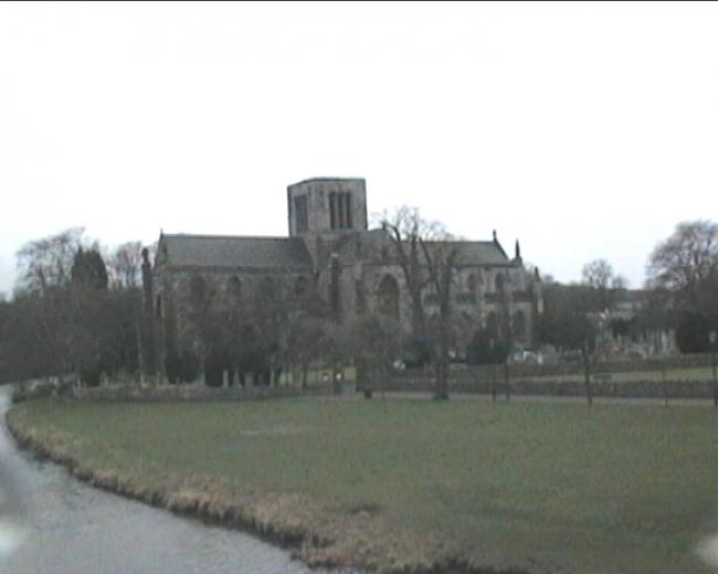
St Mary's, Haddington, Church of Scotland
hide
Hide
Hide
St Mary's,
Sidegate,
Haddington
Hide
OPRs (Old Parish Registers) dating back to 1619 (Births and Marriages) are available.
The NRS website provides further details of the surviving records.
It is located at NT5189873629 (Lat/Lon 55.953268, -2.771902). You can see this on maps provided by:
- OpenStreetMap
- Google Maps
- StreetMap (Current Ordnance Survey maps)
- Bing (was Multimap)
- Old Maps Online
- National Library of Scotland (Old Ordnance Survey maps)
- Vision of Britain (Click "Historical units & statistics" for administrative areas.)
- Magic (Geographic information) (Click + on map if it doesn't show)
- GeoHack (Links to on-line maps and location specific services.)
The parish war memorial sits inside the main entrance to the churchyard. Details of the inscription can be found on the IWM database.
Further information on the first war names can be found in Alastair Shepherds 2013 book "The Haddington War Memorial 1914-1918".