
Hide
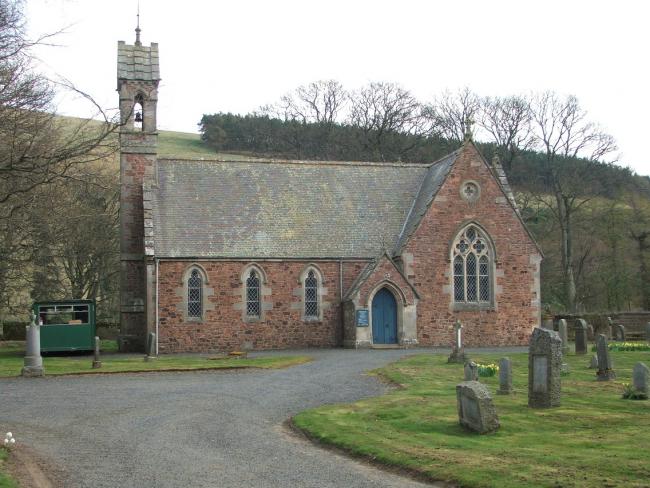
Heriot Kirk, Heriot, Church of Scotland
hide
Hide
Hide
Heriot Kirk,
Heriot
Hide
It was founded in 1800, replacing the older parish church. Chapels may have been on this site since the 16th Century.
OPRs (Old Parish Registers) are available from 1685 (Births), 1692 (Marriages), 1691 (Deaths)
There are a number of blanks, omissions, etc, details of which can be found in the NRS.
It is located at NT3903952574 (Lat/Lon 55.762653, -2.973049). You can see this on maps provided by:
- OpenStreetMap
- Google Maps
- StreetMap (Current Ordnance Survey maps)
- Bing (was Multimap)
- Old Maps Online
- National Library of Scotland (Old Ordnance Survey maps)
- Vision of Britain (Click "Historical units & statistics" for administrative areas.)
- Magic (Geographic information) (Click + on map if it doesn't show)
- GeoHack (Links to on-line maps and location specific services.)
The entrance gate to the church was remade to incorporate the parish war memorial, with 2nd war names added on a tablet adjacent to the gates.
Details of the inscriptions, and photographs, are available from the IWM database.