Hide
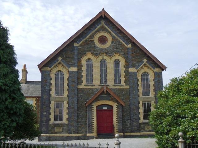
Blaen-Plwyf Welsh Calvinistic Methodist Chapel, Pontllanio, Blaenplwyf, Llanychaearn
hide
Hide
Hide
Blaen-Plwyf Chapel, Pontllanio,
,
Blaenplwyf
Cardiganshire
Hide
- The entry for this church on the National Monuments Record of Wales (NMRW) website (Coflein).
- This is the second chapel site, originally at here -- as evidenced in this extract from an article on the Ceredigion Archives site - Newsletter for March 1999
".............. an article on early Methodism in Cardiganshire written in 1859 by William Rowlands, "Cwrt-y-Cwm". The congregation had been holding services in a small cottage called "Corn" from 1803 up to 1818. At this time they approached the steward of "Nanteos", a Mr. Armstrong, with a view to leasing a piece of land so that they could build a chapel. According to William Rowlands, Colonel Powell, the owner of "Nanteos" obliged them by offering an acre of land for the sum of rent of one guinea a year. In 1819 the building of the chapel, by local craftsmen, commenced, with donations from the community making the work possible. The chapel was called "Blaenplwyf' as it was the first property on the main road to Aberystwyth in the village of Llanychaearn, the next parish being Llanddeiniol. Eventually the village of "Pont Llanio" adopted the name after a larger chapel was built there around 1880 ; this became necessary when the congregation increased during the religious revival." - See also under Church Records
It is located at SN5760575501 (Lat/Lon 52.359019, -4.09245). You can see this on maps provided by:
- OpenStreetMap
- Google Maps
- StreetMap (Current Ordnance Survey maps)
- OpenStreetMap Cymru (Welsh counties only)
- Bing (was Multimap)
- Old Maps Online
- National Library of Scotland (Old Ordnance Survey maps)
- Vision of Britain (Click "Historical units & statistics" for administrative areas.)
- Magic (Geographic information) (Click + on map if it doesn't show)
- GeoHack (Links to on-line maps and location specific services.)

