
Hide
Dorrington
hide
Hide
hide
Hide
hide
Hide
Hide
Hide
- The parish was in the Sleaford sub-district of the Sleaford Registration District.
- Check our Census Resource page for county-wide resources.
- The table below gives census piece numbers, where known:
| Census Year | Piece No. |
|---|---|
| 1841 | H.O. 107 / 617 |
| 1851 | H.O. 107 / 2100 |
| 1861 | R.G. 9 / 2342 |
| 1871 | R.G. 10 / 3349 |
| 1891 | R.G. 12 / 2577 |
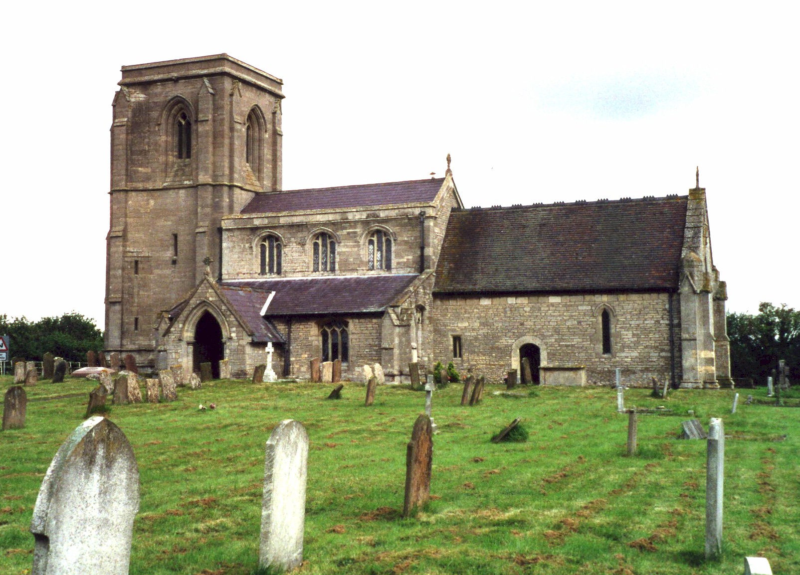
- The Anglican parish church is dedicated to Saints James and John and was built on a hill overlooking the village.
- The east wall of the church was rebuilt in 1330.
- The church was restored in 1867.
- The church seats 200.
- The village had a small chapel of ease, but this was taken down in 1698. This chapel was appropriated to Shelford Priory in Nottinghamshire.
- A photograph of Saints James and John Church is at the Wendy PARKINSON English Church Photographs site.
- Here is a photo of Saints James and John Church, taken by Ron COLE (who retains the copyright):
- The Anglican parish register dates from 1653.
- The Lincolnshire FHS has a Loan Library service which has the parish registers on microfiche for Baptisms from 1654 to 1812 and Marriages from 1654 to 1812.
- The LFHS has published several marriage and burial indexes for the Lafford Deanery to make your search easier.
- The Wesleyan Methodists had a chapel here, built in 1832, then replaced in 1881. This chapel closed for worship in 1987.
- There was also a Wesleyan Reform chapel. For information and assistance in researching these chapels, see our non-conformist religions page.
- Chris has a photograph of the Wesleyan Reform Chapel on Geo-graph, taken in June, 2013.
- Check our Church Records page for county-wide resources.
- The parish was in the Sleaford sub-district of the Sleaford Registration District.
- Check our Civil Registration page for sources and background on Civil Registration which began in July, 1837.
This village and parish are 5 miles north of Sleaford, on the B1188 trunk road. Digby parish lies to the north. The parish covers over 1,900 acres.
If you are planning a visit:
- Alex McGREGOR provides a photograph of the village entrance sign on Geo-graph, taken in 2011.
- See our touring page for more sources.
- Ask for a calculation of the distance from Dorrington to another place.
- In 1841, the Earl of Harrowby was lord of the manor and owner of most of the land in the parish.
- The national grid reference is TF 0752.
- You'll want an Ordnance Survey "Explorer 272" map, which has 2.5 inches to the mile scale.
- See our "Maps" page for additional resources.
You can see maps centred on OS grid reference TF082529 (Lat/Lon: 53.062417, -0.387096), Dorrington which are provided by:
- OpenStreetMap
- Google Maps
- StreetMap (Current Ordnance Survey maps)
- Bing (was Multimap)
- Old Maps Online
- National Library of Scotland (Old Ordnance Survey maps)
- Vision of Britain (Click "Historical units & statistics" for administrative areas.)
- English Jurisdictions in 1851 (Unfortunately the LDS have removed the facility to enable us to specify a starting location, you will need to search yourself on their map.)
- Magic (Geographic information) (Click + on map if it doesn't show)
- GeoHack (Links to on-line maps and location specific services.)
- All places within the same township/parish shown on an Openstreetmap map.
- Nearby townships/parishes shown on an Openstreetmap map.
- Nearby places shown on an Openstreetmap map.
There are war memorial plaques in the Anglican church and in the Wesleyan Reform church as well. All have names on them.
There is a list of the names from the plaques and the Rolls of Honour at the Roll of Honour site.
- This place was an ancient parish in county Lincoln and became a modern Civil Parish when those were established.
- The parish was in the ancient Flaxwell Wapentake in the North Kesteven division of the county, in the parts of Kesteven.
- You may contact the Dorrington Parish Council regarding civic or political issues, but they are NOT staffed to answer family history questions.
- For today's district governance, see the North Kesteven District Council.
- Bastardy cases would be heard in the Sleaford petty session hearings every Monday.
- The Common Lands were enclosed here in 1789 (one source gives 1878).
- The poor of the parish had an allotment of 13 acres.
- Mrs. FARMER and Mrs. KAYE each left £100, the interest to be given to the poor.
- After the Poor Law Amendment Act reforms of 1834, the parish became part of the Sleaford Poor Law Union.
- The Wesleyan Methodists had a school here prior to 1842.
- The parish had a National School here prior to 1900 that could hold 85 students.
- For more on researching school records, see our Schools Research page.