
Hide
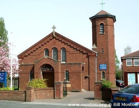
St Catherine, Heald Green, Church of England
hide
Hide
Hide
St Catherine,
Outwood Road,
Heald Green
Hide
It was founded in 1956.
Outwood Road.
Church History
Built in 1933 as a chapel to Gatley: St. James the Apostle. In 1958 it became the district church for parts of Cheadle and Gatley (previously served by Gatley: St. James the Apostle and Handforth: St. Chad). The boundaries of "The Parish of Saint Catherine, Heald Green" were described in the London Gazette on 25 February 1958:
"All those contiguous parts of the parishes of Saint James, Gatley and Saint Chad, Handforth, which are bounded upon the west by the parishes of Wilmslow, Northenden and Saint Luke Benchill, on the east by an imaginary line along the middle of Wilmslow Road, upon the south by the boundary of the Cheadle and Gatley Urban District Council and on the north by an imaginary line commencing at a point in the middle of Wilmslow Road opposite the middle of the eastern end of roadway number close 1111 and proceeding thence first westwards to and then westwards and northwestwards along -the middle of the said roadway to its junction with St. Anne's Road and continuing first northwestwards to and then southwestwards along the middle of St. Anne's Road to a point opposite the middle of the southeastern end of the roadway leading to the house and premises known as Lower House and continuing northwestwards to and along the middle of the said roadway to a point opposite the middle of the eastern end of the footpath leading from Lower House to the junction with the roadway leading past the western side of Waterfall farm and the southeastern side of Pymgate House to Styal Road and continuing first westwards to and then westwards and generally southwestwards along the middle of the said footpath and roadway to its junction with Styal Road and continuing first westwards to and then northwards along the middle of Styal Road to a point opposite .the middle of the footpath forming the northern boundary of Lumhead Wood and leading to Peel Hall Road and continuing first westwards to and then generally westwards along the middle of the said footpath to the boundary which divides the parish of Saint James, Gatley, from the parish of Saint Luke, Benchill".
Church Records
C = Christenings (Baptisms) ; M = Marriages ; B = Burials ; BTs = Bishop's Transcripts
| Original Registers | C from 1933 ; M from 1952 — Church |
- OpenStreetMap
- Google Maps
- StreetMap (Current Ordnance Survey maps)
- Bing (was Multimap)
- Old Maps Online
- National Library of Scotland (Old Ordnance Survey maps)
- Vision of Britain (Click "Historical units & statistics" for administrative areas.)
- English Jurisdictions in 1851 (Unfortunately the LDS have removed the facility to enable us to specify a starting location, you will need to search yourself on their map.)
- Magic (Geographic information) (Click + on map if it doesn't show)
- GeoHack (Links to on-line maps and location specific services.)