
Hide
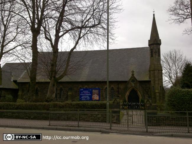
St Mary, Hollingworth, Church of England
hide
Hide
Hide
St Mary,
Market Street,
Hollingworth
Hide
It was founded in 1864.
Market Street.
Church History
Built in 1864 as a chapel to Tintwistle: Christ Church. In 1922 it became the district church for the township of Hollingworth (previously served by Tintwistle: Christ Church). The boundaries of "The District Chapel of Saint Mary, Hollingworth" were described in the London Gazette on 3 March 1922:
"All that part of the New Parish (sometime Particular District) of Christ Church, Tintwi'tle, in the County of Chester and in the Diocese of Chester, which is bounded upon the south-east by the New Parish of Saint Andrew, Hadfield, in the County of Derby .and in the Dioicese of Southwell, upon the south-west by the Parish of Mottram in Longdendale, upon the west by the New Parish of Saint Paul, Staley Bridge, upon part of the north-west by the New Parish of Saint James, Millbrook, all in the said County of Chester and in the said Diocese of Chester, and upon the remaining sides, that is to say, upon the remaining part of the north-west and upon the east, by an imaginary line commencing upon the boundary which divides the said New Parish of Saint James, Millbrook, from the said New Parish of Christ Church, Tintwisile, at the point in the middle of Brushes Reservoir where the boundaries of tihie Civil Parish of Stalyibridge, the Civil Parish oi Mossley and the Civil Parish of Hollingworth all meet, and extending thence first eastward and then in various directions along the boundary which divides the said Civil Parish of Mossley from tihe said Civil Parish of Hollingworth (thereby following in parts the course of Swineshaw Brook and passing through the Lower Swineshaw Reservoir and the Higher Slwineshaw Reservoir) for a distance of 2 miles and 13 chains or thereabouts to the point in the middle of Ogden Brook where such Civil Parish boundary meets the boundary which divides the Civil Parish of Tintwistle from the said Civil Parish of Hollingworth, and extending thence first southward and then south-westward along the middle of Ogden Brook (thereby following for the most part the last mentioned Civil Parish boundary) for a distance of 1 mile and 54 chains or thereabouts to the point on such Civil Parish boundary opposite to the middle of the weir at the northern end of the Hollingworth Reservoir, and extending thence first southward and then south-eastward along such Civil Parish boundary (thereby passing through the said Hollingworth Reservoir and the Wastelodge Reservoir and following in part the course of Hollingiworth Brook) for a distance of 1 mile and 15 chains or thereabouts to the point on the western bank of the River Etherow where such Civil Parish Bbundary meets the boundary which divides the said New Parish of Christ Churdh, Tintwistle, from the said New Parish of Saint Andrew, Hadfield, and the said County of Chester from, the said County of Derby."
Church Records
C = Christenings (Baptisms) ; M = Marriages ; B = Burials ; BTs = Bishop's Transcripts
| Original Registers | M 1922-1975 — Cheshire Archives (P 160) C from 1922 ; M from 1975 — Church |
| Copies and Indexes | M 1922-1975 — Cheshire BMD (TA:CE27) |
- OpenStreetMap
- Google Maps
- StreetMap (Current Ordnance Survey maps)
- Bing (was Multimap)
- Old Maps Online
- National Library of Scotland (Old Ordnance Survey maps)
- Vision of Britain (Click "Historical units & statistics" for administrative areas.)
- English Jurisdictions in 1851 (Unfortunately the LDS have removed the facility to enable us to specify a starting location, you will need to search yourself on their map.)
- Magic (Geographic information) (Click + on map if it doesn't show)
- GeoHack (Links to on-line maps and location specific services.)