Hide
Bulkworthy
hide
Hide
hide
- Almanacs◬
- Archives & Libraries◬
- Bibliography◬
- Biography
- Business & Commerce Records◬
- Cemeteries
- Census
- Chronology◬
- Church History
- Church Records
- Churches
- Civil Registration◬
- Correctional Institutions◬
- Court Records◬
- Description & Travel
- Directories
- Emigration & Immigration◬
- Encyclopaedias & Dictionaries◬
- Folklore◬
- Gazetteers
- Genealogy
- Handwriting◬
- Heraldry◬
- Historical Geography◬
Hide
hide
- History
- Jewish History◬
- Land & Property◬
- Language & Languages◬
- Manors◬
- Maps
- Medical Records◬
- Merchant Marine◬
- Military History
- Names, Geographical◬
- Names, Personal◬
- Newspapers◬
- Occupations◬
- Periodicals◬
- Politics & Government◬
- Poor Houses, Poor Law◬
- Population◬
- Probate Records◬
- Schools◬
- Social Life & Customs◬
- Societies◬
- Taxation◬
- Voting Registers◬
Hide
"BULKWORTHY, a small scattered village, 7 miles S.W. of Great Torrington, has in its parish 196 souls and 6050 acres of land, including Heytown hamlet, and a large tract of waste. The trustees of the late Lord Rolle are lords of the manor; but the barton of Hankford belongs to the Rev. J.M. Stevens, and several other proprietors have estates in the parish. The Church was built by Chief Justice Hankford, as appears by an inscription on the window; and the curacy is annexed to the vicarage of Buckland Brewer." [From White's Devonshire Directory (1850)]
A parish in Shebbear Hundred, the Archdeaconry of Barnstaple, and the Diocese of Exeter.
Hide
Edward Fosse, Edward (1851). William Hankford, In Judges of England: Sketches of their Lives, and Miscellaneous Notices Connected with the Courts at Westminster from the Time of the Conquest, Vol IV, London: Longman, Brown, Green and Longmans, pp. 323-326. [Index]
MIs for this parish are included in the Incledon index - see under Cemeteries on the main Devon page.
Howard, A.J. Bulkworthy Memorial Inscriptions. [SoG Library DE/M17]
Whitmore, J.B. Devonshire Monumental Inscriptions, MS at Society of Genealogists (1951). [Extracts]
Snetzler, M.F. North Devon Surname Index to the Census. Microfiche: M.F. Snetzler. [Covers 1841, 1861, 1871 and 1881 census records for this parish]
Bulkworthy - from J. Stabb. Some Old Devon Churches (London: 1908-16).
Parish Registers going back to 1709 are held in the Devon Record Office.
Transcripts of the Parish Registers going back to 1709, and of the Bishops' Transcripts going back to 1605, are held in a special collection in the Westcountry Studies Library.
The Devon FHS publishes indexes covering (as of June 2004): Marriages 1813-1837, Burials 1813-1837 - for details see their Devon Parish List.
Entered into the IGI (as of Jan 1993): Parish Church Christenings 1605-1837.
An index of baptisms, marriages and burials in the parishes of Abbotsham, Alverdiscott, Alwington, Bideford, Buckland Brewer, Bulkworthy, Clovelly, East Putford, Frithelstock, Hartland, Landcross, Littleham, Monkleigh, Northam, Parkham, Wear Gifford, Welcombe and West Woolfardisworthy. With photographs of the churches and extracts from White's Devonshire Directory 1850 and Lewis' Topographical Dictionary of England 1844, CD-ROM, Exeter, Devon FHS (2009). [Abbotsham Bapt: 1813-1840, Mar: 1754-1836, Bur: 1813-1837; Alverdiscott Bapt: 1813-1839, Mar: 1754-1837, Bur: 1775-1837; Alwington Bapt: 1813-1840, Mar: 1754-1837, Bur: 1813-1837; Bideford Bapt: 1813-1839, Mar: 1754-1837, Bur: 1813-1837; Buckland Brewer Bapt: 1813-1840, Mar: 1754-1837, Bur: 1813-1837; Bulkworthy Bapt: 1813-1841, Mar: 1814-1836, Bur: 1813-1837; Clovelly Bapt: 1813-1838, Mar: 1754-1837, Bur: 1813-1837; East Putford Bapt: 1813-1839, Mar: 1797-1837, Bur: 1813-1839; Frithelstock Bapt: 1813-1840, Mar: 1754-1837, Bur: 1813-1837; Hartland Bapt: 1838-1839, Mar: 1558-1837, Bur: 1813-1837; Landcross Bapt: 1814-1839, Mar: 1761-1836, Bur: 1813-1837; Littleham Bapt: 1813-1841, Mar: 1755-1837, Bur: 1813-1851; Monkleigh Bapt: 1813-1839, Mar: 1754-1837, Bur: 1813-1837; Northam Bapt: 1813-1839, Mar: 1754-1837, Bur: 1813-1837; Parkham Bapt: 1813-1839, Mar: 1537-1837, Bur: 1813-1837; Wear Gifford Bapt: 1813-1840, Mar: 1755-1836, Bur: 1813-1837; Welcombe Bapt: 1813-1839, Mar: 1757-1836, Bur: 1813-1837; West Woolfardisworthy Bapt: 1813-1839, Mar: 1754-1837, Bur: 1813-1837.]
Section on Bulkworthy from Samuel Lewis: A Topographical Dictionary of England (1831), provided by Mel Lockie
Transcript of complete entry in White's Devonshire Directory of 1850.
Transcription provided by Val Henderson of the entry (description and names) in Morris and Co's Commercial Directory and Gazetteer of Devonshire 1870.
The transcription of the section for this parish from the National Gazetteer (1868), provided by Colin Hinson.
- Ask for a calculation of the distance from Bulkworthy to another place.
The Online Parish Clerk for this parish is Janet Few, who invites queries and lookup requests. (Resources on fiche; census 1841-1901; tithe apportionments.)
Don Davis's blog on the Fishleigh/Fishley family contains extensive information relating to Abbots Bickington, Bulkworthy, Milton Damerel and Newton St Petrock.
Harvey, J H. Abbots Bickington and Bulkworthy. Devon and Cornwall Notes and Queries 25,4 (1952) pp. 102-4.
Williams, H.Fulford. Notes on the parish of Bulkworthy. Typescript (1963) 4p. [Westcountry Studies Library - sB/BUL/0001/WIL]
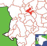
View a map of the boundaries of this town/parish.
You can see maps centred on OS grid reference SS394141 (Lat/Lon: 50.903977, -4.285457), Bulkworthy which are provided by:
- OpenStreetMap
- Google Maps
- StreetMap (Current Ordnance Survey maps)
- Bing (was Multimap)
- Old Maps Online
- National Library of Scotland (Old Ordnance Survey maps)
- Vision of Britain (Click "Historical units & statistics" for administrative areas.)
- English Jurisdictions in 1851 (Unfortunately the LDS have removed the facility to enable us to specify a starting location, you will need to search yourself on their map.)
- Magic (Geographic information) (Click + on map if it doesn't show)
- GeoHack (Links to on-line maps and location specific services.)
- All places within the same township/parish shown on an Openstreetmap map.
- Nearby townships/parishes shown on an Openstreetmap map.
- Nearby places shown on an Openstreetmap map.

