Hide
Dartmouth St Saviour
hide
Hide
hide
- Almanacs△
- Archives & Libraries◬
- Bibliography△
- Biography
- Business & Commerce Records△
- Cemeteries
- Census
- Chronology△
- Church History
- Church Records◬
- Civil Registration△
- Correctional Institutions△
- Court Records◬
- Description & Travel
- Directories◬
- Emigration & Immigration◬
- Encyclopaedias & Dictionaries△
- Folklore◬
- Gazetteers
- Genealogy
- Handwriting△
- Heraldry◬
- Historical Geography△
- History◬
Hide
hide
- Jewish History△
- Land & Property◬
- Language & Languages△
- Manors△
- Maps
- Medical Records△
- Merchant Marine◬
- Military History◬
- Military Records◬
- Names, Geographical△
- Names, Personal◬
- Newspapers◬
- Occupations◬
- Periodicals△
- Politics & Government◬
- Poor Houses, Poor Law△
- Population△
- Probate Records
- Public Records◬
- Schools△
- Social Life & Customs△
- Societies◬
- Taxation◬
- Voting Registers△
Hide
"St. Saviour's Church is an ancient and spacious structure, said to have been consecrated in 1372. It has a plain embattled tower, and the interior has a splendid screen, and several handsome monuments. In the chancel is the tomb of the before-named John Hawley, with effigies of himself and his two wives on brass plates. The altar-piece is a fine large painting of "Christ; raising the widow's son," by Brockedon, a native artist, who presented it to the church. The door within the porch is covered with curious iron ornaments, and seems to be coeval with the building." [From White's Devonshire Directory (1850)]
A parish within the seaport, market town and borough of Dartmouth, in Coleridge Hundred, the Archdeaconry of Totnes and the Diocese of Exeter, that had 1671 inhabitants in 1801. Technically this is a chapelry of Dartmouth Townstall, but in practice it is the major parish.
Hide
Thomas Tremlett (bap. St Saviour's parish 5 Jan 1770, became Chief Justice of Newfoundland), from the Dictionary of Canadian Biography.
Burial index for St Saviours Churchyard, from the Devon History Research Group.
Rogers, William Henry Hamilton: Brasses in Stoke Fleming, St Saviour's and St Petrock's, Dartmouth. (1906) [Westcountry Studies Library]
Transcript of the 1841 Census, from the Parishes of the South Hams website.
Dartmouth St Saviour - from J. Stabb. Some Old Devon Churches (London: 1908-16).
Hill, William T. St Saviour's, Dartmouth Through the Centuries. Gloucester: Brit. Publishing (1938).
Jones, Percy T. The Story of Dartmouth Parish Church. (1933) [Torquay Library]
A Brief History of Dartmouth [St Saviour's Church] [SoG Library: Devon Tracts Box]
- Ask for a calculation of the distance from Dartmouth St Saviour to another place.
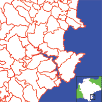
View a map of the boundaries of this town/parish.
You can see maps centred on OS grid reference SX877513 (Lat/Lon: 50.350872, -3.579828), Dartmouth St Saviour which are provided by:
- OpenStreetMap
- Google Maps
- StreetMap (Current Ordnance Survey maps)
- Bing (was Multimap)
- Old Maps Online
- National Library of Scotland (Old Ordnance Survey maps)
- Vision of Britain (Click "Historical units & statistics" for administrative areas.)
- English Jurisdictions in 1851 (Unfortunately the LDS have removed the facility to enable us to specify a starting location, you will need to search yourself on their map.)
- Magic (Geographic information) (Click + on map if it doesn't show)
- GeoHack (Links to on-line maps and location specific services.)
- All places within the same township/parish shown on an Openstreetmap map.
- Nearby townships/parishes shown on an Openstreetmap map.
- Nearby places shown on an Openstreetmap map.
Transcript of the will of Captain Sampson Shillabeer (1806), provided by Nigel Tuckett.

