
Hide
Doddiscombsleigh
hide
Hide
hide
- Almanacs◬
- Archives & Libraries◬
- Bibliography◬
- Biography◬
- Business & Commerce Records◬
- Cemeteries
- Census
- Chronology◬
- Church History
- Church Records
- Churches
- Civil Registration◬
- Correctional Institutions◬
- Court Records◬
- Description & Travel
- Directories◬
- Emigration & Immigration◬
- Encyclopaedias & Dictionaries◬
- Folklore◬
- Gazetteers
- Genealogy
- Handwriting◬
- Heraldry◬
- Historical Geography◬
Hide
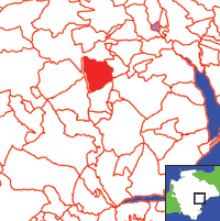
Click on map to view parish boundaries in detail.
Hide
Hide
hide
- History
- Jewish History◬
- Land & Property◬
- Language & Languages◬
- Manors◬
- Maps
- Medical Records◬
- Merchant Marine◬
- Military History◬
- Names, Geographical◬
- Names, Personal
- Newspapers◬
- Occupations◬
- Periodicals◬
- Politics & Government◬
- Poor Houses, Poor Law◬
- Population◬
- Probate Records◬
- Schools◬
- Social Life & Customs◬
- Societies
- Taxation◬
- Voting Registers◬
Hide
"DODDISCOMBLEIGH, a scattered village and parish, on bold acclivities near the sources of a rivulet, 6 miles S.. of Exeter, contains 378 souls, and 2391A. 3R. 3P. of land, including the hamlets of Lowleigh and Leigh-Cross. The manor was anciently held by the Doddiscombes, and was divided amongst their co-heiresses in the reign of Edward III. The parish now belongs to the Palk, Rodd, Buckingham, Pitman, Archer, and other families. The Town or Manor House, built in 1604, is the pleasant seat of E.G. Rodd, Esq. The Church (St. Michael,) is a fine old structure, with much stained glass in its windows, and an embattled tower, containing three bells. The rectory, valued in K.B. at $16. 6s. 5½d., and in 1831 at £312, is in the patronage and incumbency of the Rev. James Buckingham, B.C.L., who has 112A. of glebe, and a handsome residence, which was much improved in 1845, and has a finely wooded lawn of nine acres. There was anciently a small chapel at Sheldon. A Clothing Club was established here in 1843, and a Lending Library in 1846. . . . Manganese was formerly got in this parish, but the mine was closed some years ago.." [From White's Devonshire Directory (1850)]
A parish in Exminster Hundred, the Archdeaconry and the Diocese of Exeter.
Hide
MIs for this parish are included in the Devon FHS index - see under Cemeteries on the main Devon page.
Cresswell, B.F. Notes on the Churches of the Deanery of Kenn, Devon, (1912). [Extracts]
Dwelly, E. (ed.). Devon M. I. vol. 1., being all the monumental inscriptions in the parishes of Countisbury, Brendon, Martinhoe, etc. pp. v. 226. E. Dwelly: Fleet, (1918). 8o. BL 9918.aaa.1. [SoG Library]
An 1811 census of Doddiscombsleigh is to be found in the Devon Record Office (DRO 538A/PZ 2).
Doddiscombsleigh Census - 1811, Exeter, Devon Family History Society, (Booklet & PDF D052). [Foreword]
Doddiscombesleigh - from J. Stabb. Some Old Devon Churches (London: 1908-16).
Parish Registers going back to 1678 are held in the Devon Record Office.
The Devon FHS publishes indexes covering (as of June 2004): Baptisms 1813-1840, Marriages 1754-1837, Burials 1780-1837 - for details see their Devon Parish List.
Nothing entered into the IGI (as of Jan 1993).
Burials 1837 - 1857, 1858 - 1877, 1878 - 1897 and 1898 - 1917, provided by Devon Heritage.
The Deanery of Dunsford: An index of baptisms, marriages and burials in the parishes of Ashton, Bridford, Chagford, Cheriton Bishop, Christow, Doddiscombsleigh, Drewsteignton, Dunsford, Gidleigh, Hittisleigh, Holcombe Burnell, South Tawton, Spreyton, Tedburn St. Mary, Throwleigh and Whitestone. With photographs of the churches and extracts from White's Devonshire Directory 1850. CD-ROM, Exeter, Devon FHS (2009). [Ashton Bapt: 1813-1839, Mar: 1754-1837, Bur: 1740-1837; Bridford Bapt: 1813-1839, Mar: 1754-1837, Bur: 1800-1837; Chagford Bapt: 1813-1839, Mar: 1754-1837, Bur: 1813-1837; Cheriton Bishop Bapt: 1813-1840, Mar: 1754-1841, Bur: 1813-1837; Christow Bapt: 1813-1840, Mar: 1757-1844, Bur: 1813-1837; Doddiscombsleigh Bapt: 1813-1840, Mar: 1755-1836, Bur: 1780-1837; Drewsteignton Bapt: 1813-1839, Mar: 1754-1837, Bur: 1813-1837; Dunsford Bapt: 1813-1839, Mar: 1754-1837, Bur: 1813-1837; Gidleigh Bapt: 1813-1839, Mar: 1748-1812 (BT's), Mar: 1814-1837, Bur: 1813-1884; Hittisleigh Bapt: 1813-1840, Mar: 1754-1837, Bur: 1813-1839; Holcombe Burnell Bapt: 1813-1840, Mar: 1754-1836, Bur: 1753-1837; South Tawton Bapt: 1813-1839, Mar: 1754-1837, Bur: 1813-1837; Spreyton Bapt: 1803-1839, Mar: 1754-1837, Bur: 1800-1837; Tedburn St. Mary Bapt: 1813-1839, Mar: 1754-1837, Bur: 1813-1837; Throwleigh Bapt: 1813-1841, Mar: 1754-1837, Bur: 1813-1837; Whitestone Bapt: 1813-1840, Mar: 1754-1837, Bur: 1813-1837.]
Conservation Area Appraisal for Doddiscombesleigh - an interesting account of the area, with numerous photographs and maps.
Section on Doddiscombsleigh from Samuel Lewis: A Topographical Dictionary of England (1831), provided by Mel Lockie.
The transcription of the section for this parish from the National Gazetteer (1868), provided by Colin Hinson.
- Ask for a calculation of the distance from Doddiscombsleigh to another place.
The Online Parish Clerk for this parish is Thomas Peeke, who invites queries and lookup requests.
This parish is one of the growing number of places for which the Devon Heritage website provides census or parish register transcriptions, articles, and/or illustrations, etc.
Jean, P. Dingle Family of Doddiscombsleigh and Dunsford, (2002). [Devon FHS Library p929.2/DIN]
Barber, Chips. The Teign Valley of Yesteryear. Obelisk Publications (1994) 32 p. [ISBN-13:978-1899073085]
Barber, Chips. The Teign Valley of Yesteryear - Part 2. Obelisk Publications (1996) 32 p. [ISBN-13:978-1899073351]
Buckingham, F.F. Doddiscombleigh: A short history of the parish, incumbents, church and stained glass windows. Yeovil: Western Gazette. (1927?) 19p: ill. [Westcountry Studies Library, - s726.5/DOD/BUC]
View a map of the boundaries of this town/parish.
You can see maps centred on OS grid reference SX857865 (Lat/Lon: 50.666915, -3.618716), Doddiscombsleigh which are provided by:
- OpenStreetMap
- Google Maps
- StreetMap (Current Ordnance Survey maps)
- Bing (was Multimap)
- Old Maps Online
- National Library of Scotland (Old Ordnance Survey maps)
- Vision of Britain (Click "Historical units & statistics" for administrative areas.)
- English Jurisdictions in 1851 (Unfortunately the LDS have removed the facility to enable us to specify a starting location, you will need to search yourself on their map.)
- Magic (Geographic information) (Click + on map if it doesn't show)
- GeoHack (Links to on-line maps and location specific services.)
- All places within the same township/parish shown on an Openstreetmap map.
- Nearby townships/parishes shown on an Openstreetmap map.
- Nearby places shown on an Openstreetmap map.
Doddiscombsleigh contributors to a 1678 brief for the rebuilding of St Paul's Cathedral.
Protestation Return for 1641, provided by Devon Heritage.
A List of inhabitants of the Parish of Doddiscombleigh (1811), provided by Malcolm Diggines.
Teign Valley History group - Honorary Secretary: Graham Thompson