Hide
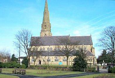
St Luke, Heywood, Church of England
Hide
Maintainers
The updates have been applied on the "anchor" issue on 27 July.
The issues are discussed here
Details are also on the maintainers list.
hide
Hide
Hide
St Luke,
York St,
Heywood
Lancashire
Hide
The church had a graveyard. The graves were all exhumed in the early 1970's and the remains transferred to Heywood cemetery as the land was required for building.
It was founded before 1552. St Lukes church, which dominates the centre of the town, started life as a chantry chapel for the Heywood family. Robert Heywood rebuilt the chapel in 1640. The growth of Heywood as a cotton town in the 19th century meant that the chapel was too small and so in 1859 it was pulled down. The new church was consecrated on St Lukes Day 1862.
The church was consecrated in October 1862 following a very successful public subscription appeal. Prior to it being built,the Old Heywood Chapel, in Market Place, was demolished in 1859 for the new St Lukes to be built. Some details of the Old Heywood Chapel is that it had been altered in 1805 and initials R.H. 1686 standing for Robert Heywood of Heywood hall who had possibly developed around the chapel and Market place close by. St Lukes Church had restoration work done on the church bells around 1911 as a memorial to King Edward V11. The cost of this work was around £480. The trial ringing took place on the 28th March 1911. The bell restorers were Gillett and Johnston of Croydon.
This site provides historical information about churches, other places of worship and cemeteries. It has no connection with the churches themselves. For current information you should contact them directly.
Baptisms
1733-1812
Transcript of baptisms 1733-1812 by the Lancashire Parish Register Society - Volume 161
1745-1900
1807-1842
1813-1837
Transcript of baptisms 1813-1837 by the Lancashire Parish Register Society - Volume 165
Marriages
1733-1812
Transcript of marriages 1733-1812 by the Lancashire Parish Register Society - Volume 161
1813-1837
Transcript of marriages 1813-1837 by the Lancashire Parish Register Society - Volume 165
1837-1895
Burials
1733-1812
Transcript of burials 1733-1812 by the Lancashire Parish Register Society - Volume 161
1745-1906
1813-1837
Transcript of burials 1813-1837 by the Lancashire Parish Register Society - Volume 165
1829-1842
- OpenStreetMap
- Google Maps
- StreetMap (Current Ordnance Survey maps)
- Bing (was Multimap)
- Old Maps Online
- National Library of Scotland (Old Ordnance Survey maps)
- Vision of Britain (Click "Historical units & statistics" for administrative areas.)
- English Jurisdictions in 1851 (Unfortunately the LDS have removed the facility to enable us to specify a starting location, you will need to search yourself on their map.)
- Magic (Geographic information) (Click + on map if it doesn't show)
- GeoHack (Links to on-line maps and location specific services.)

