
Hide
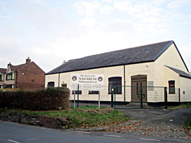
Helena Rd, St Helens, Church of the Nazarene
hide
Hide
© Sue Adair
Hide
Church of the Nazarene,
Helena Rd,
St Helens
Helena Rd,
St Helens
Hide
It opened in the 1950s, see Sutton History for more details. It closed in 2015.
It was located at SJ5372293191 (Lat/Lon 53.433459, -2.698023). You can see this on maps provided by:
- OpenStreetMap
- Google Maps
- StreetMap (Current Ordnance Survey maps)
- Bing (was Multimap)
- Old Maps Online
- National Library of Scotland (Old Ordnance Survey maps)
- Vision of Britain (Click "Historical units & statistics" for administrative areas.)
- English Jurisdictions in 1851 (Unfortunately the LDS have removed the facility to enable us to specify a starting location, you will need to search yourself on their map.)
- Magic (Geographic information) (Click + on map if it doesn't show)
- GeoHack (Links to on-line maps and location specific services.)