
Hide
Bassingham
hide
Hide
hide
Hide
hide
Hide
Hide
"A parish in the lower division of the wapentake of Boothby-Graffoe, parts of Kestevan, county of Lincoln, 9 miles (S.W. by S) from Lincoln, containing 613 inhabitants. The living is a rectory in the Archdeaconry and diocese of Lincoln, rated in the King's books at 26, 16, 3 BPS and in the patronage of the President and Fellows of Corpus Christi College, Oxford. The church is dedicated to St. Michael. There is a place of worship for Wesleyan Methodists. The rector allows an annuity of 4BPS for teaching poor children. The several manor-houses in the parish are occupied as farm-houses."
Topographical Dictionary of England 1831, page 108
Hide
The Library at Newark on Trent will prove useful in your research.
- The parish was in the Bassingham sub-district of the Newark Registration District.
- Check our Census Resource page for county-wide resources.
- The table below gives census piece numbers, where known:
Census
YearPiece No. 1841 H.O. 107 / 615 1861 R.G. 9 / 2477 1881 R.G. 11 / 3374 1891 R.G. 12 / 2712 1901 R.G. 13 / 3062
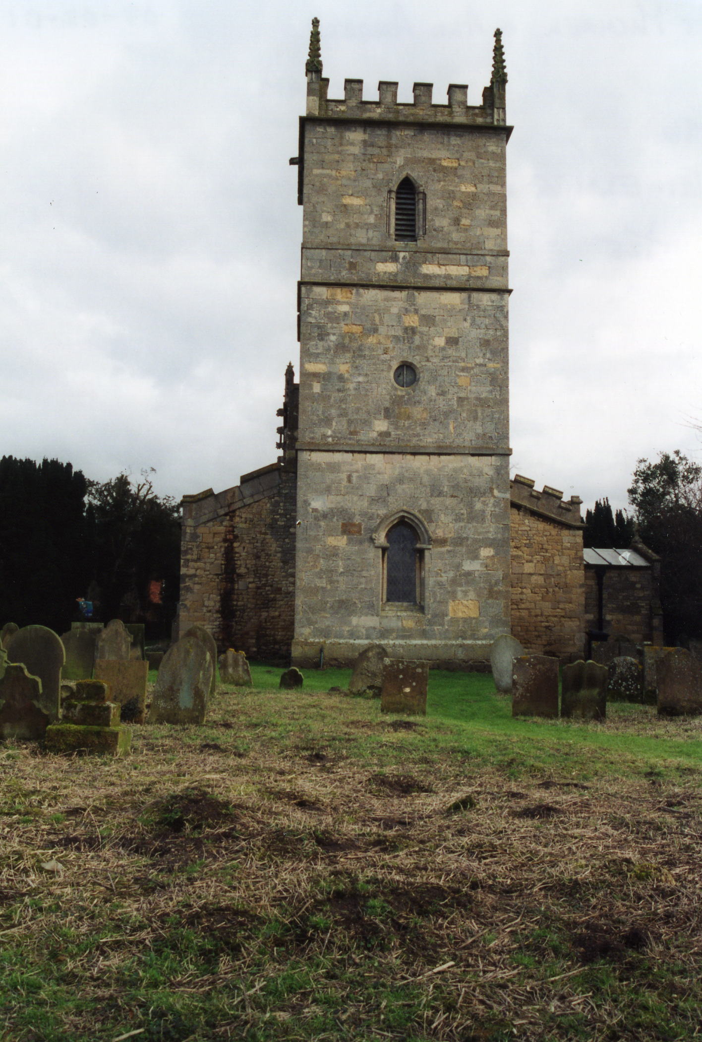
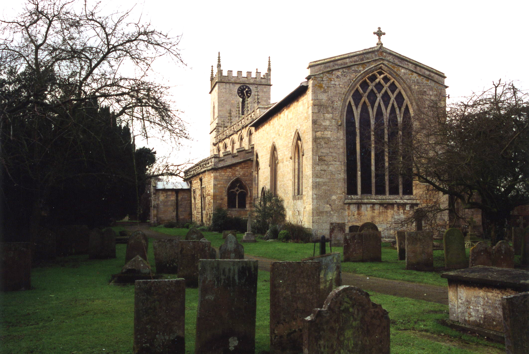
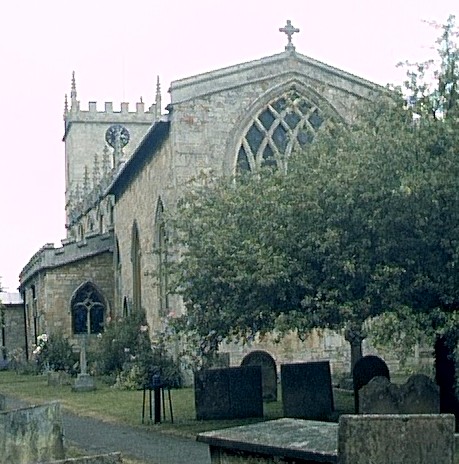
- The Anglican parish church is dedicated to Saint Michael and is of the Gothic style.
- Parts of the church are thought to date from the 10th century.
- The tower was rebuilt in 1782 and again in 1887, and the church underwent a complete restoration in 1860.
- The church seats 300.
- Here is a photo of the church, taken by (and copyright of) Wendy PARKINSON:
- The parish register dates from 1572, but Bishop's transcripts go back another ten years to 1562.
- We have a partial register extract with entries from 1838 to 1850.
- Parish registers are on file at the Society of Genealogists, covering 1572 - 1812.
- Marriages are in Boyd's Marriage Index, covering 1651 - 1812 and Pallot's Marriage Index, covering 1790 - 1812.
- FreeREG has Bassingham Marriages, 1572 -1812 in their database.
- The LFHS has published several indexes (marriage and burial) for the Graffoe Deanery to make your search easier.
- The Wesleyan Methodists built a large chapel here in 1839. Tours of this chapel are normally available on weekends. That same year, the Primitive Methodists also built a small chapel and, in 1859, the Reformed Methodists did the same. A Salvationist Mission Hall was also built here in the late 1800's.
- Wendy PARKINSON has a photograph of the Wesleyan Methodist Church on Geo-graph, taken in April, 2007.
- For information and assistance in researching these chapels, see our non-conformist religions page.
- Check our Church Records page for county-wide resources.
- The parish was in the Bassingham sub-district of the Newark Registration District.
- Check our Civil Registration page for sources and background on Civil Registration which began in July, 1837.
Bassingham is a parish and village approximately 9 miles SSW of Lincoln and 9 miles NE of Newark on Trent. Thurlby parish borders on the north-west, Norton Disney lies to the west and Carlton le Moorland to the south. The River Witham is part of the northern and western border. The parish covers about 1,980 acres.
The village of Bassingham lies just south-east of the River Withern. If you are planning a visit:
- Consider eating at or staying at the Five Bells Inn at 17 High Street (tele: (01522) 788269) near the centre of the village.
- Chris has a photograph of The Village Sign on Geo-graph, taken in January, 2014.
- Visit our touring page for more sources.
- Ask for a calculation of the distance from Bassingham to another place.
Richard CROFT has a photograph of The Bugle Horn Pub. on Geo-graph, taken in June, 2012. The Pub has its own website.
- The principal landowners in 1871 were Lieut.-Colonel REEVE, MR. Charles Barber MARFLEET, Mr. John BROCKLEBANK and Mr. Conyers BOOTH.
- See our Maps page for additional resources.
You can see maps centred on OS grid reference SK911599 (Lat/Lon: 53.128491, -0.639948), Bassingham which are provided by:
- OpenStreetMap
- Google Maps
- StreetMap (Current Ordnance Survey maps)
- Bing (was Multimap)
- Old Maps Online
- National Library of Scotland (Old Ordnance Survey maps)
- Vision of Britain (Click "Historical units & statistics" for administrative areas.)
- English Jurisdictions in 1851 (Unfortunately the LDS have removed the facility to enable us to specify a starting location, you will need to search yourself on their map.)
- Magic (Geographic information) (Click + on map if it doesn't show)
- GeoHack (Links to on-line maps and location specific services.)
- All places within the same township/parish shown on an Openstreetmap map.
- Nearby townships/parishes shown on an Openstreetmap map.
- Nearby places shown on an Openstreetmap map.
- The War Memorial is an obelisk of polished Aberdeen granite that was set in place near the church in 1920.
- J. THOMAS has a photograph of the War Memorial outside the church on Geo-graph, taken in April, 2012.
- The HMS Bassingham (M2605) was named after this village. She was a Ham-class inshore minesweeper launched in 1952.
For a photograph of the War Memorial and the names on the plinth, see the Roll of Honour site.
- The name Bassingham is from the Old English Bassa+inga+ham, or "homestead of the family or followers of Bassa". In the 1086 Domesday Book, the village is given as Basingeham.
["A Dictionary of English Place-Names," A. D. MILLS, Oxford University Press, 1991]
- Here is a partial list of surnames found in the parish in 1871: DALTON, GELL, HARSTON, HOLMES, JOHNSON, KELLEY, MARTIN, ROBINSON, RODGERS, SEWARD, SPAFFORD, UFFINGDALE and WILSON.
- This place was an ancient parish in Lincoln county and became a modern Civil Parish when those were established.
- The parish was in the Low Division of the ancient Graffoe Wapentake in the North Kesteven division of the county, in the parts of Kesteven.
- You may contact the local Bassingham Parish Council regarding civic or politcal issues, but they are NOT staffed to help you with family history lookups.
- For today's district governance, see the North Kesteven District Council.
- Bastardy cases would be heard in the Lincoln South petty session hearings.
- Care of the poor dates back to at least 1680 when The Poor Close was purchased to generate an annual rental income. Both John LAMBE and John GARNETT contributed to that purchase.
- Poole SAVAGE donated £200 in 1823 which was used to purchase Lark Close for their benefit.
- In 1714, Robert JESSOP dedicated a yearly rent charge of 10 shillings from the rental of Four Acres Close.
- Jonathan THACKER has a photograph of the parish workhouse on Geo-graph, taken in November, 2020.
- After the Poor Law Amendment Act reforms of 1834, the parish became part of the Newark Poor Law Union in 1837.
- The National School was erected in 1855 and was attended by about 90 students.
- Oliver DIXON has a photograph of some Primary School Mosiacs on Geo-graph, taken in October, 2012.
- The Wesleyan School was built that same year and was attended by about 150 students.
- For more on researching school records, see our Schools Research page.