
Hide
Morham, Church of Scotland
hide
Hide
Hide
Church of Scotland,
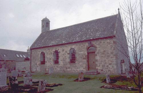
Morham
Hide
The current church was built in 1724, on the site of an earlier church and graveyard.
Some archeaological, and historical notes, together with photographs, are available from the Canmore database.
Old Parish Registers (OPRs) are available from 1712 for Births and Marriages. Deaths are only available from 1712 - 1742, and 1783 - 1805. (Note - names of deceased person are "not unfrequently omitted before 1742").
Further details of gaps and issues with the records can be found on the NRS website.
It is located at NT5565872593 (Lat/Lon 55.944323, -2.711522). You can see this on maps provided by:
- OpenStreetMap
- Google Maps
- StreetMap (Current Ordnance Survey maps)
- Bing (was Multimap)
- Old Maps Online
- National Library of Scotland (Old Ordnance Survey maps)
- Vision of Britain (Click "Historical units & statistics" for administrative areas.)
- Magic (Geographic information) (Click + on map if it doesn't show)
- GeoHack (Links to on-line maps and location specific services.)
The church contains a first war communion table, and a second war lectern as memorials. Details of the inscriptions can be found on the IWM database.