Hide
Combe Raleigh
hide
Hide
hide
- Almanacs◬
- Archives & Libraries◬
- Bibliography◬
- Biography
- Business & Commerce Records◬
- Cemeteries
- Census
- Chronology◬
- Church History
- Church Records
- Churches
- Civil Registration◬
- Correctional Institutions◬
- Court Records◬
- Description & Travel
- Directories◬
- Emigration & Immigration◬
- Encyclopaedias & Dictionaries◬
- Folklore◬
- Gazetteers
- Genealogy
- Handwriting◬
- Heraldry◬
- Historical Geography◬
Hide
hide
- History
- Jewish History◬
- Land & Property
- Language & Languages◬
- Manors
- Maps
- Medical Records◬
- Merchant Marine◬
- Military History◬
- Names, Geographical◬
- Names, Personal◬
- Newspapers◬
- Occupations◬
- Periodicals◬
- Politics & Government◬
- Poor Houses, Poor Law◬
- Population◬
- Probate Records
- Schools◬
- Social Life & Customs◬
- Societies◬
- Taxation◬
- Voting Registers◬
Hide
"COMBE RAWLEIGH, or Comb Ralegh, a small village, on the bold western acclivity of the Otter valley, 1½ mile N.W. of Honiton, has in its parish 276 souls, and 1747 acres of land, rising to a lofty elevation, overlooking Honiton and the surrounding country. On the highest point, was one of the telegraphs between London and Plymouth. The manor was successively held by the Baunton, Matthews, Ralegh, Dennis, and other families. It is now held by the Rev. Wm. Bernard, but part of the soil belongs to Mrs. Woodward and other freeholders. The Church (St. Nicholas,) is of the age of the 15th century, and has a tower and three bells. . . . The rectory, valued in K.B. at £20. 0s. 10d., and in 1831 at £295, is in the patronage of E.S. Drewe, Esq., and incumbency of the Rev. C.E. Band, M.A. who has a good residence, in a romantic nook, having an extensive prospect in front, but sheltered on other sides by woody hills. . . " [From White's Devonshire Directory (1850)]
A parish in Axminster Hundred, the Archdeaconry and the Diocese of Exeter.
Hide
Harpley, Rev. W. Rev William Downes, B.A. [Obituary]. Trans. Devon. Assoc., 1887, Vol XIX, pp.42-43. [Transcript]
MIs for this parish are included in the Incledon index - see under Cemeteries on the main Devon page.
A local census of Coombe Raleigh, of 1898-1907, listing all inhabitants, is held at the Devon Record Office (DRO 567A add/P1 53).
Doidge, B.C. The church and parish of Combe Raleigh, Devon: a history. (1974) 22p. [Westcountry Studies Library - 726.5/COM/DOI]
Parish Registers going back to 1653 are held in the Devon Record Office.
The Devon FHS publishes indexes covering (as of June 2004): Baptisms 1813-1839, Marriages 1754-1837 - for details see their Devon Parish List.
Nothing entered into the IGI (as of Jan 1993).
The Deanery of Dunkeswell, CD012, Devon Family History Society, Exeter (2007). [Contains indexes: Awliscombe - Baptisms 1813-1839, Marriages 1754-1837, Burials 1813-1837; Churchstanton - Baptisms 1813-1837, Marriages 1754-1837, Burials 1813-1839; Clayhidon - Baptisms 1813-1839, Marriages 1754-1837, Burials 1813-1837; Combe Raleigh - Baptisms 1813-1839, Marriages 1754-1837, Burials 1813-1837; Dunkeswell - Baptisms 1813-1839, Marriages 1754-1837, Burials 1800-1837; Hemyock - Baptisms 1813-1839, Marriages 1635-1837, Burials 1813-1837; Luppitt - Baptisms 1813-1839, Marriages 1754-1838, Burials 1813-1837; Sheldon - Baptisms 1813-1839, Marriages 1755-1836, Burials 1770-1837; Upottery - Baptisms 1813-1839, Marriages 1754-1837, Burials 1813-1837; Yarcombe - Baptisms 1813-1839, Marriages 1754-1837, Burials 1813-1837.]
Section on Combe Raleigh from Samuel Lewis: A Topographical Dictionary of England (1831), provided by Mel Lockie.
The transcription of the section for this parish from the National Gazetteer (1868), provided by Colin Hinson.
- Ask for a calculation of the distance from Combe Raleigh to another place.
Davies, Dr. Coral. 19th Century Godfrees at Combe Raleigh, Devon Family Historian, vol. 148, (2013) pp.27-33.
Spreadsheet transcription of the Tithe Apportionments.
Bernard of Crowcombe. List of Combe Raleigh Manor documents deposited by Bernard of Crowcombe in the Devon Record Office. Typescript (1970?) 42p.
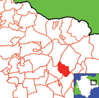
View a map of the boundaries of this town/parish.
You can see maps centred on OS grid reference ST158023 (Lat/Lon: 50.814105, -3.196531), Combe Raleigh which are provided by:
- OpenStreetMap
- Google Maps
- StreetMap (Current Ordnance Survey maps)
- Bing (was Multimap)
- Old Maps Online
- National Library of Scotland (Old Ordnance Survey maps)
- Vision of Britain (Click "Historical units & statistics" for administrative areas.)
- English Jurisdictions in 1851 (Unfortunately the LDS have removed the facility to enable us to specify a starting location, you will need to search yourself on their map.)
- Magic (Geographic information) (Click + on map if it doesn't show)
- GeoHack (Links to on-line maps and location specific services.)
- All places within the same township/parish shown on an Openstreetmap map.
- Nearby townships/parishes shown on an Openstreetmap map.
- Nearby places shown on an Openstreetmap map.
Transcript of the will of William Rosewell (1878) by Colin Rosewell.

