
Hide
Chipping
hide
Hide
hide
Hide
hide
Hide
Hide
CHIPPING, a township, a parish, and a sub-district in Clitheroe district, Lancashire. The township lies on a branch of the river Hodder, 3¾ miles NW of the Longridge railway, and 7 E by S of Garstang; and has a post office under Preston, and fairs on Easter Tuesday and 24 Aug. Acres, 5, 577. Real property, £5,567. Pop., 1,074. Houses, 229. The parish includes also the township of Thornley-with-Wheatley. Acres, 8,756. Real property, £8,217. Pop., 1,483. Houses, 311. The property is much subdivided. The manor belonged, before the Conquest, to Richard de Chepin. The cotton manufacture is largely carried on; and limestone occurs. The living is a vicarage in the diocese of Manchester. Value, £120. Patron, the bishop of Manchester. The church was reported in 1859 to need repair. There are chapels for Independents and Roman Catholics; and charities, £260. The sub-district contains also parts of two other parishes. Acres, 22,226. Pop., 3,217. Houses, 590.
John Marius Wilson, Imperial Gazetteer of England and Wales (1870-72)
Hide
Local studies information is held at Clitheroe library.
| Providence Chapel Independent, Chipping |
| St Mary, Chipping, Roman Catholic |
Details about the census records, and indexes for Chipping.
| Hesketh Lane, Hesketh Lane, Independent |
| Providence Chapel Independent, Chipping |
| St Mary, Chipping, Roman Catholic |
The Register Office covering the Chipping area is Ribble Valley.
The National Gazetteer of Great Britain and Ireland - 1868
"CHIPPING, a parish in the lower division of the hundred of Blackburn, in the county of Lancaster, 5 miles from Longridge, 8½ E. of the Garstang railway station, and 12 N.E. of Preston. It is situated on a branch of the river Hodder, and contains the townships of Chipping and Thornley with Wheatley. In this village is an iron foundry. The living is a vicarage in the diocese of Manchester, value £120, in the patronage of the bishop. The church, dedicated to St. Bartholomew, is a stone edifice, with tower and a peal of six bells. The register commences in the year 1550. Here is a Roman Catholic chapel and school. A free school for the education of 24 boys stands in the village, which was endowed, in 1684, by John Brabbin; over the school door is inscribed, "Dote, Disce, vol Discede.""
- Ask for a calculation of the distance from Chipping to another place.
In 1835 the parish of Chipping contained the townships of Chipping and Thornley with Wheatley.
The history of Chipping from Pigot's Lancashire directory, 1830.
View maps of Chipping and places within its boundaries.
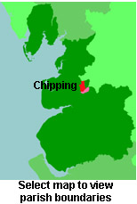
View a map of the boundaries of this town/parish.
You can see maps centred on OS grid reference SD603436 (Lat/Lon: 53.88675, -2.605605), Chipping which are provided by:
- OpenStreetMap
- Google Maps
- StreetMap (Current Ordnance Survey maps)
- Bing (was Multimap)
- Old Maps Online
- National Library of Scotland (Old Ordnance Survey maps)
- Vision of Britain (Click "Historical units & statistics" for administrative areas.)
- English Jurisdictions in 1851 (Unfortunately the LDS have removed the facility to enable us to specify a starting location, you will need to search yourself on their map.)
- Magic (Geographic information) (Click + on map if it doesn't show)
- GeoHack (Links to on-line maps and location specific services.)
- All places within the same township/parish shown on an Openstreetmap map.
- Nearby townships/parishes shown on an Openstreetmap map.
- Nearby places shown on an Openstreetmap map.
For probate purposes prior to 1858, Chipping was in the Archdeaconry of Richmond, in the Diocese of Chester. The original Lancashire wills for the Archdeaconry of Richmond are held at the Lancashire Record Office.
You can also see Family History Societies covering the nearby area, plotted on a map. This facility is being developed, and is awaiting societies to enter information about the places they cover.