
Hide
The Good Shepherd, Tatham Fell, Church of England
hide
Hide
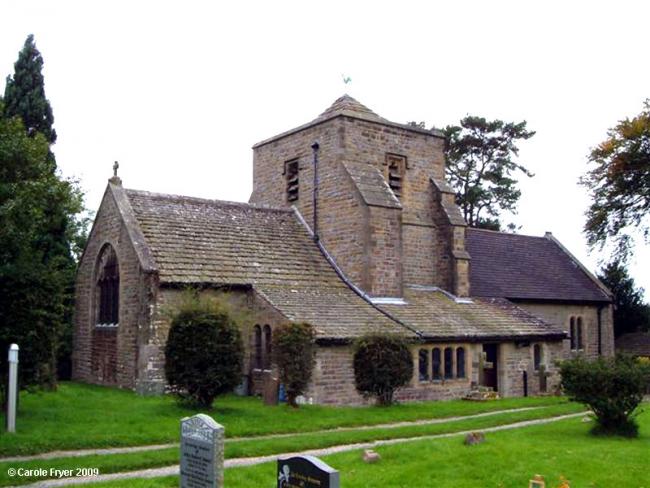
Photograph supplied by & Copyright of Carole Fryer.
Hide
The Good Shepherd,
Tatham Fell
Lancashire
Hide
1760-1979
Transcript of monumental inscriptions 1760-1979 held by Lancashire Archives - Searchroom
Baptisms
1745-1837
Transcript of baptisms 1745-1837 by the Lancashire Parish Register Society - Volume 078
1745-1934
Original Registers of baptisms 1745-1934 held by Lancashire Archives - PR 2918 3339
1812-1865
Copy of Bishop's Transcript of baptisms 1812-1865 held by Lancashire Archives - DRB 2/198-199
Marriages
1746-1754
Transcript of marriages 1746-1754 by the Lancashire Parish Register Society - Volume 078
1916-1951
Original Registers of marriages 1916-1951 held by Lancashire Archives - PR 2918 3339
Burials
1745-1812
Original Registers of burials 1745-1812 held by Lancashire Archives - PR 2918 3339
1745-1837
Transcript of burials 1745-1837 by the Lancashire Parish Register Society - Volume 078
1812-1865
Copy of Bishop's Transcript of burials 1812-1865 held by Lancashire Archives - DRB 2/198-199
It is located at SD6540165373 (Lat/Lon 54.0831, -2.530358). You can see this on maps provided by:
- OpenStreetMap
- Google Maps
- StreetMap (Current Ordnance Survey maps)
- Bing (was Multimap)
- Old Maps Online
- National Library of Scotland (Old Ordnance Survey maps)
- Vision of Britain (Click "Historical units & statistics" for administrative areas.)
- English Jurisdictions in 1851 (Unfortunately the LDS have removed the facility to enable us to specify a starting location, you will need to search yourself on their map.)
- Magic (Geographic information) (Click + on map if it doesn't show)
- GeoHack (Links to on-line maps and location specific services.)