Hide
West Butterwick
hide
Hide
hide
Hide
hide
Hide
Hide
West Butterwick, vil., Owston par., Lincolnshire; on river Trent, 5½ miles NE. of Epworth; P.O
From: John BARTHOLOMEW's "Gazetteer of the British Isles (1887)"
Hide
The Gainsborough Library is an excellent resource with both a Local History section and a Family History section.
Alternatively, the nearby Brigg Library also has a Local History section.
- The parish was in the Owston sub-district in the Gainsborough Registration District.
- Check our Census Resource page for county-wide resources.
- The table below gives census piece numbers, where known:
| Census Year | Piece No. |
|---|---|
| 1861 | R.G. 9 / 2405 |
| 1871 | R.G. 10 / 3439 |
| 1891 | R.G. 12 / 2631 |
- The Anglican parish church is dedicated to Saint Mary the Virgin.
- The church was built in 1841.
- Originally a township in Owston parish, West Butterwick was made an ecclesiastical parish in its own right in 1841, right after the church was ordained.
- The church seats 200.
- There is a photograph of St. Mary's Church on the Wendy PARKINSON Church Photos web site.
- David HITCHBORNE has a photograph of St. Mary's Church on Geo-graph, taken in 2004.
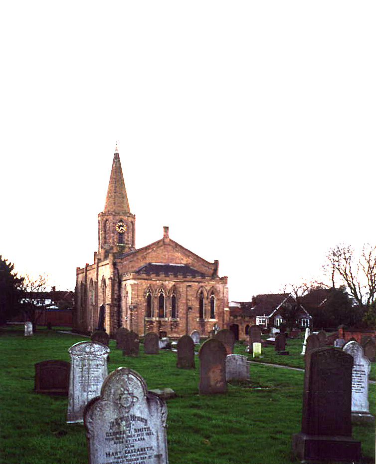
- Here is a photo of St. Mary's Church, taken by Ron COLE (who retains the copyright):

- The Anglican parish register dates only from 1845 (except for baptisms which date back to 1825). For earlier register entries, see Owston parish.
- Check the Isle of Axholme Deanery to see which LFHS marriage indexes exist.
- A Wesleyan Methodist chapel was built in 1836. The parish also had a Primitive Methodist chapel and a General Baptist chapel.
- Richard CROFT has a photograph of the derelict Primitive Methodist chapel on Geo-graph, taken in 2006.
- Check our Church Records page for county-wide resources.
- The parish was in the Owston sub-district in the Gainsborough Registration District.
- Check our Civil Registration page for sources and background on Civil Registration which began in July, 1837.
West Butterwick is NOT one of the eight original parishes in the Isle of Axholme in the far northwest corner of Lincolnshire. The parish was formed in 1845 from part of Owston parish. Prior to that, it had been a "township" in Owston parish. The parish lies 12 miles north of Gainsborough. Kelfield is a hamlet, 3 miles south of the village, on the west bank of the Trent River.
The village lies spread along the west bank of the Trent River. If you are planning a visit:
- See our touring page for more sources.
- Ask for a calculation of the distance from West Butterwick to another place.
Chris MORGAN provides a photograph of the Three Horseshoes Inn on Geo-graph, taken in December, 2015.
See our Maps page for additional resources.
You can see maps centred on OS grid reference SE823048 (Lat/Lon: 53.533031, -0.759142), West Butterwick which are provided by:
- OpenStreetMap
- Google Maps
- StreetMap (Current Ordnance Survey maps)
- Bing (was Multimap)
- Old Maps Online
- National Library of Scotland (Old Ordnance Survey maps)
- Vision of Britain (Click "Historical units & statistics" for administrative areas.)
- English Jurisdictions in 1851 (Unfortunately the LDS have removed the facility to enable us to specify a starting location, you will need to search yourself on their map.)
- Magic (Geographic information) (Click + on map if it doesn't show)
- GeoHack (Links to on-line maps and location specific services.)
- All places within the same township/parish shown on an Openstreetmap map.
- Nearby townships/parishes shown on an Openstreetmap map.
- Nearby places shown on an Openstreetmap map.
- Jonathan THACKER has a photograph of the War Memorial at St. Mary's churchyard on Geo-graph, taken in 2012.
For a photograph of the West Butterwick Ferry War Memorial and the list of names on it, see the Roll of Honour site.
The name 'Butterwick' comes from the Old English butere-wick meaning 'butter farm'.
- This place was an ancient Chapelry and township in Owston parish in Lincoln county and became a modern Civil Parish in 1845.
- The parish was in the western division of the ancient Manley Wapentake in the Gainsborough district in the parts of Lindsey.
- In May, 1845, West Butterwick parish was formed from the northeast portion of Owston parish.
- In March, 1886, the Turbary portion of this parish was annexed to Haxey Civil Parish.
- In the 1972 government redistricting, West Butterwick became part of the Boothferry District, which was in the County of Humberside (formerly Lindsey, Lincolnshire).
- District governance is currently provided by the North Lincolnshire Council.
- As a result of the 1834 Poor Law Amendment Act, the parish became part of the Gainsborough Poor Law Union.
- Bastardy cases would be heard in the Epworth petty session hearings.
For more on researching school records, see our Schools Research page.
The local genealogical society is the Isle of Axholme FHS.
