
Hide
Chillingham
hide
Hide
hide
Hide
Hide
Hide
"CHILLINGHAM is a small parish bounded on the north by Chatton, on the west and south by Ellingham, and on the east by Bambrough Ward. It is a fertile and well cultivated district, comprising the townships of Chillingham, Hebburn, and Newton, whose united area is 4,926 acres. The population in 1801, was 451; in 1811, 301; in 1821, 356; in 1831, 477; in 1841, 459; and in 1851, 380 souls. This decrease of population is attributed partly to the employment of fewer labourers on farms which have been laid down to pasture, and partly to the reduction of the establishment at the castle." [From History, Topography, and Directory of Northumberland, Whellan, 1855].
Hide
- Northumberland County Record Office holds copies of Census Returns 1841 - 1891 and provides a useful User Guide
- The 1851 Census Index (microfiche CN35)
- 1891 Census Wooler (Doddington, Nesbit, Fenton, Ewart, Earle, Humbleton, Middleton Hall, North and South Middleton, Ilderton, Roseden, Roddam, Selbys Forest, Akeld, Woller, Chatton, Chillingham, Hepburn, Newton, East and West Lilburn, Old and New Bewick, Brandon, Wooperton, Branton, Fawdon and Clinch, Reavley, Linhope, Greenside Hill and Hartside) (PRO piece RG12/4271) (Type B) (Book) (Volume 81) BOTH published by the https://www.ndfhs.org.uk/ may be of value to researchers interested in this parish.
Church of England Records.
- Chillingham, St Peter: Records of baptisms 1692-1991, marriages 1692-1991 and burials 1692-1991 are available at Northumberland Record Office
- Bishops' Transcripts for the period 1760-1868 are deposited at Durham University Library Archives and Special Collections, Palace Green, Durham City.
- The International Genealogical Index (I.G.I.) includes baptisms 1692-1812 and marriages 1692-1812 for this parish, and Boyd's Marriage Index includes marriages 1692-1812 and banns 1756-1812.
- Transcripts of baptisms, burials and marriages 1692-1812 for Chillingham are available at Newcastle Central Library, Local Studies Dept. A transcript of monumental inscriptions at Chillingham (microfiche TN74) is published by Northumberland and Durham Family History Society and these records are also available in book form at Newcastle Central Library, Local Studies Department.
- External and internal views of Chillingham, St Peter and a photograph of a tomb inside the church. Photographs supplied by George Bell.
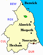
Adjacent Parishes.
- This area is within Northumberland North First Registration District.
- Certificates of birth, death and marriage can be ordered from Northumberland County Council.
- The Northumberland Communities website includes pages relating to Chillingham. They provide "a range of learning resource material that reflects Northumberland's heritage, providing a base for studying the County's history. The website provides a starting point for understanding the development of communities in Northumberland. It also seeks to illustrate the range of sources for family and local history research that are available via Northumberland Archives Service."
- The section of The National Gazetteer (1868) relating to this parish - transcribed by Colin Hinson.
- Ask for a calculation of the distance from Chillingham to another place.
- The history of Chillingham Parish is included in:- Northumberland County History Committee, History of Northumberland, Volume 14. Newcastle, A. Reid, 1935. (Available on fiche from Ancestral Indexes).
- Maps of locations in this parish provided by Streetmap.
Chillingham, Hebburn/Hepburn, Newtown.
You can see maps centred on OS grid reference NU058255 (Lat/Lon: 55.522866, -1.909946), Chillingham which are provided by:
- OpenStreetMap
- Google Maps
- StreetMap (Current Ordnance Survey maps)
- Bing (was Multimap)
- Old Maps Online
- National Library of Scotland (Old Ordnance Survey maps)
- Vision of Britain (Click "Historical units & statistics" for administrative areas.)
- English Jurisdictions in 1851 (Unfortunately the LDS have removed the facility to enable us to specify a starting location, you will need to search yourself on their map.)
- Magic (Geographic information) (Click + on map if it doesn't show)
- GeoHack (Links to on-line maps and location specific services.)
- All places within the same township/parish shown on an Openstreetmap map.
- Nearby townships/parishes shown on an Openstreetmap map.
- Nearby places shown on an Openstreetmap map.