
Hide
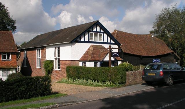
Rudgwick Chapel, Rudgwick, Congregational
hide
Hide
© Copyright Andy Potter and licensed for reuse under this Creative Commons Licence.
Hide
Rudgwick Chapel,
Church Street,
Rudgwick
Church Street,
Rudgwick
Hide
It was founded in 1824. It is now closed, but we do not know the date of closure .
Originally built for the Congregationalists, the church is now used by an Evangelical congregation.
In 1972 the Congregational church joined with the English Presbyterian church to become the United Reformed Church. Some Congregational churches though did not take this path and became members of the Congregational Federation.
It was located at TQ0900034020 (Lat/Lon 51.095141, -0.44482). You can see this on maps provided by:
- OpenStreetMap
- Google Maps
- StreetMap (Current Ordnance Survey maps)
- Bing (was Multimap)
- Old Maps Online
- National Library of Scotland (Old Ordnance Survey maps)
- Vision of Britain (Click "Historical units & statistics" for administrative areas.)
- English Jurisdictions in 1851 (Unfortunately the LDS have removed the facility to enable us to specify a starting location, you will need to search yourself on their map.)
- Magic (Geographic information) (Click + on map if it doesn't show)
- GeoHack (Links to on-line maps and location specific services.)