Hide
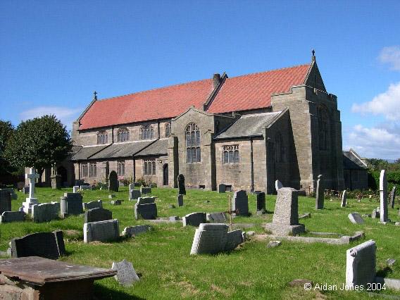
St Mary the Virgin, Walney, Church of England
hide
Hide
Hide
St Mary the Virgin,
Church Lane,
Walney
Lancashire
Hide
Biggar and North Scale are the only hamlets on the island, and intermediate between the two is the church of St. Mary. The date of its erection is uncertain, but is was in existence as early as 1577, and was probably built before the downfall of Furness Abbey. In the inquisition of 1650 it is styled Wana Chapel, and the whole chapelry, embracing the island of Wana contained only sixty families. The inhabitants do not appear at that time to have been in a very flourishing condition, or else they were supinely indifferent to the creature comforts of their minister, for the whole sum contributed towards his maintenance was 6s. 6d. per year. They also prayed to be made parochial, but their request was not granted, and the living remains a perpetual curacy, in the gift of the vicar of Dalton. The incumbency, worth £180, is now held by the Rev. H. M. Burgess, B.A., Dublin. The area of the ecclesiastical district is 12,800 acres.
The present church is a small but neat structure, erected upon the site of the old chapel. In the burial ground lie the remains of Mr. Close, an antiquarian of repute, who edited the last edition of West's Antiquities of Furness. Near the church is the school, erected by Mrs. Michaelson, of Barrow Island, to the memory of her husband. It is now under the management of the School Board.
from Mannex's Directory of Furness & Cartmel, 1882
Hide
The church has/had a graveyard. The monumental incriptions have been separately recorded and published in two websites. Walney Monumental Inscriptions and Walney Graves.
It was founded in 1577. Walney was originally a chapelry of Dalton, probably founded in the 16th century and achieving parish church status in the 19th century. The present church is at least the third to be built within the same churchyard, reflecting the steady growth in the population of Walney. Its foundation stone was laid in 1907, but the building was not completed until 1930. (The previous church was in the same yard, but slightly to the south. It was dismantled a few years after the completion of the present building. However its four corner stones, left as markers, can still be seen.)
There were no separate chapel registers until 1744 [typed transcripts 1744-1858 in Cumbria Record Office, Barrow, and also at the Society of Genealogists library in London]. The Cumbria Record Office, Barrow hold:
- Baptisms 1744-1972
- Marriages 1837-1990
- Banns 1859-1981
- Burials 1744-1964
Baptisms
1744-1856
Transcript of baptisms 1744-1856 by the Lancashire Parish Register Society - Volume 185
1856-1874
Marriages
1837-1859
Transcript of marriages 1837-1859 by the Lancashire Parish Register Society - Volume 185
1858-1872
Burials
1745-1858
Transcript of burials 1745-1858 by the Lancashire Parish Register Society - Volume 185
1856-1874
- OpenStreetMap
- Google Maps
- StreetMap (Current Ordnance Survey maps)
- Bing (was Multimap)
- Old Maps Online
- National Library of Scotland (Old Ordnance Survey maps)
- Vision of Britain (Click "Historical units & statistics" for administrative areas.)
- English Jurisdictions in 1851 (Unfortunately the LDS have removed the facility to enable us to specify a starting location, you will need to search yourself on their map.)
- Magic (Geographic information) (Click + on map if it doesn't show)
- GeoHack (Links to on-line maps and location specific services.)

