
Hide
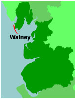
Walney
hide
Hide
hide
Hide
hide
Hide
Hide
WALNEY, an island and a chapelry in Dalton-in-Furness parish, Lancashire. The island is separated from Lower Furness by a narrow strait; adjoins, in its central part, the harbour and town of Barrow-in-Furness; extends south-south-eastward, from the month of the Duddon's estuary to the N side of the entrance of Morecambe bay; measures 8 miles in length, and nowhere more than 1 mile in breadth; is low, flat, and distributed into about a dozen farms; contains two small villages; is surmounted, at the S end, by a lighthouse 68 feet high, erected in 1790; and has a post-office under Barrow-in-Furness. The chapelry includes one or two neighbouring islets; and its statistics are returned with the parish. The living is a p. curacy in the diocese of Carlisle. Value, £140. Patron, the Vicar of Dalton. The church is recent. There is a national school.
John Marius Wilson, Imperial Gazetteer of England and Wales (1870-72)
Hide
Local studies information is held at Cumbria Record Office & Local Studies Library, Barrow.
Details about the census records, and indexes for Walney.
| St Andrew, Walney, Presbyterian |
| St Columba, Roman Catholic, Walney |
The Register Office covering the Walney area is Barrow in Furness.
The National Gazetteer of Great Britain and Ireland - 1868
"ISLE OF WALNEY, a chapelry in the parish of Dalton in Furness, hundred of Lonsdale North of the Sands, county Lancaster, 5 miles S.W. of Dalton. This place, which is insular at high water, is situated between Morecambe Bay and the river Dudden, opposite the village and port of Barrow, which is reached by a ferry. It contains the villages of North Scales and Bigger. A lighthouse was erected in 1790 at the southern end of the island, which has a revolving light 70 feet high, and visible for 13 miles. The sea is gradually encroaching upon the land, which was formdrly an extensive forest, but has now scarcely a tree. Several rare plants grow here, and at North Scale is an intermittent well. On the northern extremity of the island stands the castle of the "Pile of Fouldrey," erected in 1327 by the Abbot of Furness for the protection of the inner harbour. It was once of consiDerable strength, but is now a ruin. The living is a perpetual curacy in the diocese of Carlisle, value £90, in the patronage of the Vicar of Dalton. The church, dedicated to St. Mary, was restored in 1856. A National school has been recently erected.
"FOUDRAY, (or Peel Of Foudray), a small island near Walney Island, county palatine Lancaster. On it stand the ruins of a tower built by the abbots of Furness."
"NORTH SCALE-FORCE, a waterfall in Walney Island, county Lancaster, 5 miles S.W. of Dalton."
"PIEL, (or Peel Of Fouldrey), an islet in the chapelry of Walney, parish of Dalton-in-Furness, county Lancaster, 6 miles S. byW. of Dalton. It is situated in Morecambe Bay, near Walney Island, and has the remains of an old castle of the Abbots of Furness. Lambert Simnel and his adherents landed here in 1487. There is a line of railway from Piel Pier to Broughton."
"FOULNEY, an island in the parish of Dalton-in-Furness, hundred of Lonsdale North of the Sands, county palatine Lancaster, 7 miles S.E. of Dalton."
"BIGGAR, a hamlet in the chapelry of Walney, and parish of Dalton-in-Furness, hundred of Lonsdale, in the county palatine of Lancaster, near Dalton. It lies near the coast of Morecombe Bay."
- Ask for a calculation of the distance from Walney to another place.
In 1835 Walney was a chapelry in the parish of Dalton in Furness.
View maps of Walney and places within its boundaries.
View a map of the boundaries of this town/parish.
You can see maps centred on OS grid reference SD201674 (Lat/Lon: 54.096194, -3.223757), Walney which are provided by:
- OpenStreetMap
- Google Maps
- StreetMap (Current Ordnance Survey maps)
- Bing (was Multimap)
- Old Maps Online
- National Library of Scotland (Old Ordnance Survey maps)
- Vision of Britain (Click "Historical units & statistics" for administrative areas.)
- English Jurisdictions in 1851 (Unfortunately the LDS have removed the facility to enable us to specify a starting location, you will need to search yourself on their map.)
- Magic (Geographic information) (Click + on map if it doesn't show)
- GeoHack (Links to on-line maps and location specific services.)
- All places within the same township/parish shown on an Openstreetmap map.
- Nearby townships/parishes shown on an Openstreetmap map.
- Nearby places shown on an Openstreetmap map.
For probate purposes prior to 1858, Walney was in the Archdeaconry of Richmond, in the Diocese of Chester. The original Lancashire wills for the Archdeaconry of Richmond are held at the Lancashire Record Office.
You can also see Family History Societies covering the nearby area, plotted on a map. This facility is being developed, and is awaiting societies to enter information about the places they cover.