Hide
Penwortham
hide
Hide
hide
Hide
hide
Hide
Hide
PENWORTHAM, a village, a township, and a parish, in Preston district, Lancashire. The village stands on the river Ribble, near the Northwestern railway, 1½ mile S W of Preston; and has a post-office under Preston. The township contains also the village of Middleforth-Green, and the hamlet of Charnock-Moss; and comprises 2,277 acres. Real property, £7,221; of which £30 are in fisheries. Pop. in 1851, 1,487; in 1861, 1,506. Houses, 271. P. Priory, P. Hall, P. House, the Oaks, Hurst Grange, White Friars, and Swallow House are chief residences. An ancient castle stood here, to guard the navigation of the Ribble; but was long ago erased. A Benedictine priory, a cell to Evesham abbey, was founded here, in the time of the Conqueror, by Warine Bussel; was given, at the dissolution, to the Fleetwoods; and has left no remains. The parish contains also the townships of Howick, Hutton, Longton, and Farington. Acres, 11,317; of which 1,450 are water. Real property, £26,169. Pop. in 1851, 5,722; in 1861, 5,488. Houses, 996. The property is subdivided. Bricks and tiles are made in Howick; and brewing and malting are carried on in Longton. The living is a p. curacy in the diocese of Manchester. Value, £125.* Patron, L. Rawstorne, Esq. The church is of the 14th century; was partly rebuilt, partly enlarged, in 1856; consists of nave, aisles, and chancel, with porch and low tower; and contains handsome monuments of the Fleetwoods and the Rawstornes. The p. curacies of Longton and Farington are separate benefices. A chapel of ease, a Wesleyan chapel, a workhouse for female children, an endowed grammar school, and charities £70 are in P. township; and dis-senting chapels and public schools are in the other townships.
John Marius Wilson, Imperial Gazetteer of England and Wales (1870-72)
Hide
Local studies information is held at Leyland library.
Details about the census records, and indexes for Penwortham.
| Liverpool Rd Congregational, Penwortham |
The Register Office covering the Penwortham area is Preston and South Ribble
- Ask for a calculation of the distance from Penwortham to another place.

View maps of Penwortham and places within its boundaries.
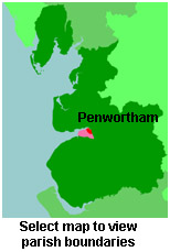
View a map of the boundaries of this town/parish.
You can see maps centred on OS grid reference SD523275 (Lat/Lon: 53.741823, -2.725365), Penwortham which are provided by:
- OpenStreetMap
- Google Maps
- StreetMap (Current Ordnance Survey maps)
- Bing (was Multimap)
- Old Maps Online
- National Library of Scotland (Old Ordnance Survey maps)
- Vision of Britain (Click "Historical units & statistics" for administrative areas.)
- English Jurisdictions in 1851 (Unfortunately the LDS have removed the facility to enable us to specify a starting location, you will need to search yourself on their map.)
- Magic (Geographic information) (Click + on map if it doesn't show)
- GeoHack (Links to on-line maps and location specific services.)
- All places within the same township/parish shown on an Openstreetmap map.
- Nearby townships/parishes shown on an Openstreetmap map.
- Nearby places shown on an Openstreetmap map.
For probate purposes prior to 1858, Penwortham was in the Archdeaconry of Chester, in the Diocese of Chester. The original Lancashire wills for the Archdeaconry of Chester are held at the Lancashire Record Office.
You can also see Family History Societies covering the nearby area, plotted on a map. This facility is being developed, and is awaiting societies to enter information about the places they cover.
