
Hide
Hatfield
hide
Hide
hide
Hide
Hide
The Ancient Parish of HATFIELD
[Transcribed information mainly from the early 1820s]
"HATFIELD, a parish-town, in the upper-division of Strafforth and Tickhill (the seat of W. Gossip, Esq.) 3 miles SSW. of Thorne, 8 from Doncaster, 11 from Bawtry, 34 from York. Pop. 1,948. The Church is a perpetual curacy, dedicated to St. Lawrence, in the deanry of Doncaster, value, p.r. £80. 4s. 3d. Patron, Lord Deerhurst, in right of his Wife. Bacon styles it a vicarage, value, £15. 5s." (There is further information for Hatfield).Information on the following places in this Parish is contained on a supplementary page.
|
|
[Description(s) edited from various 19th century sources by Colin Hinson © 2013]
Hide
- Here are photographs of Churches etc. in the parish:
- St. Lawrence's Church, Hatfield.
- The Methodist Church, Hatfield Woodhouse.
- St. Mary's Church, Stainforth.
- The Methodist Church, Stainforth.
- Our Lady of the Assumption R.C. Church, Stainforth.
- St. Edwin's Church, Dunscroft (view 1).
- St. Edwin's Church, Dunscroft (view 2).
- The Methodist Chapel, Dunsville.
- The former Salem Chapel, High Levels.
- The former Methodist Church, Goodcop.
- Transcript of the entry for Hatfield in the "Collections relative to Churches and Chapels".
- Transcript of the entry for Stainforth in the "Collections relative to Churches and Chapels".
- The whereabouts and dates of the Registers etc. for the Parish of Hatfield.
- Transcript of the entry of "professions and trades" in the Baines's Directory and Gazetteer, Vol I, West Riding.
- There is further information about this parish from the Pigot's 1829 Directory, Yorkshire section.
- There is further information about this parish from the Pigot's 1834 Directory, Yorkshire section.
- There is further information about this parish from the National Gazetteer 1868, Yorkshire extracts.
- There is further information about this parish from the Lewis's Topographical Dictionary of England, Yorkshire extracts.
- There is further information about this parish from the Stephen Whatley's Gazetteer 1750, Yorkshire extracts.
- Ask for a calculation of the distance from Hatfield to another place.
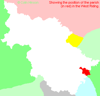
- For a detailed map of this parish see this parish boundaries map.
- For a more detailed map of the parishes in the riding please see the Yorkshire parish maps page.
- For a more detailed map of the county please see the Yorkshire map page.
- Here is a map showing the wapentakes for the county.
You can see maps centred on OS grid reference SE660097 (Lat/Lon: 53.57975, -1.004628), Hatfield which are provided by:
- OpenStreetMap
- Google Maps
- StreetMap (Current Ordnance Survey maps)
- Bing (was Multimap)
- Old Maps Online
- National Library of Scotland (Old Ordnance Survey maps)
- Vision of Britain (Click "Historical units & statistics" for administrative areas.)
- English Jurisdictions in 1851 (Unfortunately the LDS have removed the facility to enable us to specify a starting location, you will need to search yourself on their map.)
- Magic (Geographic information) (Click + on map if it doesn't show)
- GeoHack (Links to on-line maps and location specific services.)
- All places within the same township/parish shown on an Openstreetmap map.
- Nearby townships/parishes shown on an Openstreetmap map.
- Nearby places shown on an Openstreetmap map.
- The World Wars I and II memorial in Stainforth Cemetery.
- The Memorial Plaque at the British Legion.
- The following places are within the boundaries of this (ancient) parish, but I have no further information on them other than the Ordnance Survey Landranger Grid reference shown:
- (SE680102) Brierholme Carr
- (SE645078) Dunsville
- This parish is covered by the following Society:
- A list of those paying the 1379 Subsidy Rolls (Poll Tax) for this parish.