
Hide
Mirfield
hide
Hide
hide
Hide
Hide
The Ancient Parish of MIRFIELD
[Transcribed information mainly from the early 1820s]
"MIRFIELD, a parish-town, in Agbrigg-division of Agbrigg and Morley, liberty of Pontefract; 3 miles SW. of Dewsbury, 4½ from Huddersfield, 8 from Wakefield, 35 from York. Pop. 5,041. The Church is a vicarage, dedicated to St. Mary, in the deanry of Pontefract, value, ~£6. 1s. 0½d. p.r. £150. Patron, Sir George Armitage, Bart. The rectory of Mirfield, nearly fifty years ago, was let for £210. per annum, though estimated in 1540, at no more than £6. 6s. 8d." (There is further information for Mirfield)."BLAKE HALL, (the residence of Mrs. Ingham) in the township and parish of Mirfield; 3 miles from Dewsbury, 6½ from Huddersfield.
In this house was born, John Hopton, Bishop of Norwich, of a very considerable family, residing alternately at Blake Hall and Armley, near Leeds. He was a Dominican Friar, educated at Oxford, from whence, after his course of study was completed, he travelled to Rome, and took the degree of D.D. at Bologna. He was chaplain to Princess Mary, soon after whose accession to the crown, he was nominated to the See of Norwich, which he enjoyed to his death. --Whitaker's Loidis and Elmete."
"HOPTON, a hamlet in the township and parish of Mirfield, 3½ miles NE. of Huddersfield."
"HUNGER HILL, 3 farm-houses in the township and parish of Mirfield, 7 miles E. of Huddersfield."
"NORTHORPE, a hamlet in the township and parish of Mirfield, 2½ miles from Dewsbury, 5 from Wakefield."
"NUNBROOK, a hamlet in the township and parish of Mirfield, 4½ miles NNE. of Huddersfield, 8½ from Wakefield, 11 from Leeds."
"QUARRY HILL, a hamlet in the township and parish of Mirfield, 2½ miles W. of Dewsbury, 5½ from Huddersfield."
"TOWN GATE, a hamlet in the township and parish of Mirfield, 2½ miles from Dewsbury, 6 from Wakefield."
[Description(s) edited from various 19th century sources by Colin Hinson © 2013]
Hide
- The following MIs are available on the Kirkheaton.info website (you will need to register (free)):
- Here are photographs of Churches etc. in the parish:
- The remains of the old St. Mary's Church, Mirfield.
- St. Mary's Church, Mirfield. (The Church's website is here.)
- The Plaque about St. Mary's Church
- Looking down the nave
- The East Window
- The Font
- The stocks outside St. Mary's Church
- The Moravian Church, Wellhouse. The Church is among the buidings on the right.
- The former Primitive Methodist Chapel, Mirfield.
- The Church of St. John the Evangelist, Upper Hopton.
- The former Congregational/United Reformed Church, Lower Hopton. Built in 1829 as a Congregational chapel to replace an earlier building.
- St. Saviour's Church, Ravensthorpe.
- The United Reformed Church, Ravensthorpe.
- St. Andrew's Methodist Church, Mirfield.
- The Evangelical Church, Wellhouse. (The Church's website is here.)
- St. Aidan's Roman Catholic Church, Mirfield.
- The Trinity Methodist Church, Mirfield.
- St. Paul's Church, Mirfield.
- The Zion Baptist Church, Mirfield. The church was behind the two trees, but had to be demolished several years ago, and now the former Sunday School is used for worship.
- Church of the College of the Order of the Resurrection, Mirfield, an Anglican Theological college. (The Church's website is here.)
- The Church of Christ the King, Battyeford. Founded in 1840, this building was opened in 1973.
- The Salvation Army Worship Hall, Mirfield.
- The Kingdom Hall of Jehovah's Witnesses, Mirfield.
- A transcription of Mirfield Baptist Church History
- A transcription of the Hopton Congregational Church History
- Transcript of the entry for Mirfield in the "Collections relative to Churches and Chapels".
- Mirfield Plague Victims 1631.
- The whereabouts and dates of the Registers etc. for the Parish of Mirfield.
- Here is a photograph of Hopton Hall
- Transcript of the entry of "professions and trades" in the Baines's Directory and Gazetteer, Vol I, West Riding.
- Transcript of the entry of "professions and trades" in the Pigot's 1834 Directory, Yorkshire section.
- There is further information about this parish from the Pigot's 1829 Directory, Yorkshire section.
- There is further information about this parish from the Pigot's 1834 Directory, Yorkshire section.
- There is further information about this parish from the National Gazetteer 1868, Yorkshire extracts.
- There is further information about this parish from the Lewis's Topographical Dictionary of England, Yorkshire extracts.
- Ask for a calculation of the distance from Mirfield to another place.
- The Mirfield Memories site has various histories of Mirfield.
- A transcription of the Hopton Congregational Church History
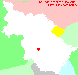
- For a detailed map of this parish see this parish boundaries map.
- For a more detailed map of the parishes in the riding please see the Yorkshire parish maps page.
- For a more detailed map of the county please see the Yorkshire map page.
- Here is a map showing the wapentakes for the county.
You can see maps centred on OS grid reference SE200199 (Lat/Lon: 53.67519, -1.698724), Mirfield which are provided by:
- OpenStreetMap
- Google Maps
- StreetMap (Current Ordnance Survey maps)
- Bing (was Multimap)
- Old Maps Online
- National Library of Scotland (Old Ordnance Survey maps)
- Vision of Britain (Click "Historical units & statistics" for administrative areas.)
- English Jurisdictions in 1851 (Unfortunately the LDS have removed the facility to enable us to specify a starting location, you will need to search yourself on their map.)
- Magic (Geographic information) (Click + on map if it doesn't show)
- GeoHack (Links to on-line maps and location specific services.)
- All places within the same township/parish shown on an Openstreetmap map.
- Nearby townships/parishes shown on an Openstreetmap map.
- Nearby places shown on an Openstreetmap map.
- The following places are within the boundaries of this (ancient) parish, but I have no further information on them other than the Ordnance Survey Landranger Grid reference shown:
- (SE197187) Upper Hopton
- (SE221203) Ravensthorpe
- This parish is covered by the following Society:
- A list of those paying the 1379 Subsidy Rolls (Poll Tax) for this parish.
- A transcription of the Poll Book for Mirfield in 1835.