Hide
Ormskirk
hide
Hide
hide
Hide
hide
Hide
Hide
"ORMSKIRK, a town, a township, a parish, a sub-district, and a district, in Lancashire. The town stands on the East Lancashire railway, at the junction of the branch from St. Helens, 2½ miles S E of the Leeds and Liverpool canal, and 12 N by E of Liverpool. The manor belonged, till the Reformation, to Burscough priory; and belongs now to the Earl of Derby. The town is well-built; contains four chief streets, going rectangularly from a central market-place; is governedby a local board of health, and well supplied with gas and water; is a seat of petty sessions and county-courts, and a polling-place; publishes two weekly newspapers; and has a head post-office, a railway station with telegraph, a banking office, two chief inns, a town hall and corn-market, a sessions-house and magistrates' rooms, a news-room and library, a church, three dis-senting chapels, a free grammar-school, a national school, a dispensary, a workhouse, and charities £354. The dissenting chapels are Independent, Wesleyan, and Unitarian. The free grammar-school was founded in 1614, under the will of Henry Ascroft; is a Tudor structure, in Ruff-lane; and has an endowed income of £139. The national school was erected by voluntary contributions; is a stone building in the Tudor style, in Derby-street; possesses capacity forupwards of 800 scholars; and the Sunday school has an endowed income of £28. The dispensary is a small but ornamental building, in the Doric style, in Burscough-street. The workhouse stands in Wigan-road; was built at a cost of about £4,000; and, at the census of 1861, had 76 inmates. A weekly market is held on Thursday; cattle fairs are held on Whit-Monday, Whit-Tuesday, and 10 Sept.; rope-making and hand-loom silk-weavingare carried on; and there are several breweries, and an iron-foundry. Acres of the town, 572. Real property, £13, 597; of which £323 are in gas-works. Pop. in 1851, 6,183; in 1861, 6,426. Houses, 1,193." more ...
John Marius Wilson, Imperial Gazetteer of England and Wales (1870-72)
Hide
Ormskirk Library,
Burscough Street,
Ormskirk
L39 2EN
| St Anne, Ormskirk, Roman Catholic |
Details about the census records, and indexes for Ormskirk.
| St Helens Rd, Ormskirk, Congregational |
| Fogg's Chapel, Ormskirk, Presbyterian |
| St Anne, Ormskirk, Roman Catholic |
The Register Office covering the Ormskirk area is West Lancashire
- Ask for a calculation of the distance from Ormskirk to another place.
In 1835 the parish of Ormskirk contained the townships of Ormskirk, Skelmersdale, Scarisbrick, Burscough, Lathom, Bickerstaffe and Simonswood.
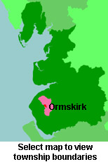
View a map of the boundaries of this town/parish.
You can see maps centred on OS grid reference SD420078 (Lat/Lon: 53.563791, -2.87749), Ormskirk which are provided by:
- OpenStreetMap
- Google Maps
- StreetMap (Current Ordnance Survey maps)
- Bing (was Multimap)
- Old Maps Online
- National Library of Scotland (Old Ordnance Survey maps)
- Vision of Britain (Click "Historical units & statistics" for administrative areas.)
- English Jurisdictions in 1851 (Unfortunately the LDS have removed the facility to enable us to specify a starting location, you will need to search yourself on their map.)
- Magic (Geographic information) (Click + on map if it doesn't show)
- GeoHack (Links to on-line maps and location specific services.)
- All places within the same township/parish shown on an Openstreetmap map.
- Nearby townships/parishes shown on an Openstreetmap map.
- Nearby places shown on an Openstreetmap map.
The Workhouse site has an interesting description of Ormskirk workhouse.
For probate purposes prior to 1858, Ormskirk was in the Archdeaconry of Chester, in the Diocese of Chester. The original Lancashire wills for the Archdeaconry of Chester are held at the Lancashire Record Office. Ormskirk and District Family History Society.
You can also see Family History Societies covering the nearby area, plotted on a map. This facility is being developed, and is awaiting societies to enter information about the places they cover.

