
Hide
Routh
hide
Hide
hide
Hide
Hide
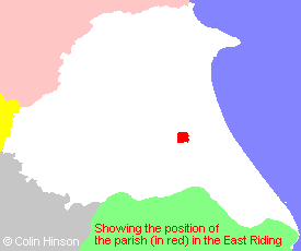
The Ancient Parish of ROUTH
[Transcribed information mainly from the early 1820s]
"ROUTH, a parish in the wapentake & liberty of Holderness; 4½ miles NE. of Beverley. The church, dedicated to All Saints, is a very ancient structure (see Churches for photograph), and the living, which is a rectory, in the patronage of the Misses Ellerkers, is enjoyed by the Rev. John L. Hutchinson. Pop. 124.In the church is a mutilated effigy of a Knight Templar; and brasses of a Knight and his Lady, in good preservation, except the inscription, which has been torne off."
[Description(s) edited mainly from various 19th century sources by Colin Hinson. ©2010]
Hide
- Photographs of the over 120 gravestones in Routh Churchyard with a surname index.
- Here are photographs of Churches etc. in the parish:
- All Saints' Church, Routh (they have carefully hidden this church behind trees).
- All Saints' Church, Routh.
- The Tree next to the porch, All Saints', Routh. Would you have a tree this close to one of your buildings?
- The Christadelphian Meeting House, Routh.
- Transcript of the entry for Routh in the "Collections relative to Churches and Chapels".
- The whereabouts and dates of the Registers etc. for the Parish of Routh.
- Transcript of the entry of "professions and trades" in the Baines's Directory of 1823, of the East Riding.
- Transcript of the entry of "professions and trades" in the Bulmers Directory of 1892. of the East Riding.
- There is further information about this parish from the National Gazetteer 1868, Yorkshire extracts.
- There is further information about this parish from the Lewis's Topographical Dictionary of England 1835, Yorkshire extracts.
- There is further information about this parish from the Bulmer's 1892 History and Directory of the East Riding.
- Ask for a calculation of the distance from Routh to another place.
- For a detailed map of this parish see this parish boundaries map.
- For a more detailed map of the parishes in the riding please see the Yorkshire parish maps page.
- For a more detailed map of the county please see the Yorkshire map page.
- Here is a map showing the wapentakes for the county.
You can see maps centred on OS grid reference TA090428 (Lat/Lon: 53.869969, -0.343761), Routh which are provided by:
- OpenStreetMap
- Google Maps
- StreetMap (Current Ordnance Survey maps)
- Bing (was Multimap)
- Old Maps Online
- National Library of Scotland (Old Ordnance Survey maps)
- Vision of Britain (Click "Historical units & statistics" for administrative areas.)
- English Jurisdictions in 1851 (Unfortunately the LDS have removed the facility to enable us to specify a starting location, you will need to search yourself on their map.)
- Magic (Geographic information) (Click + on map if it doesn't show)
- GeoHack (Links to on-line maps and location specific services.)
- All places within the same township/parish shown on an Openstreetmap map.
- Nearby townships/parishes shown on an Openstreetmap map.
- Nearby places shown on an Openstreetmap map.
- This parish is covered by the following Society:
- The 1834 Electoral Roll for this parish