Hide
Garstang
hide
Hide
hide
Hide
hide
Hide
Hide
GARSTANG, a small town, a township, a parish, a sub-district, and a district in Lancashire. The town stands on the river Wyre, the Preston and Lancaster canal, and the Preston and Lancaster railway, 11 miles South of Lancaster. It was occupied by the Pretender, for a short time, in 1715. It is irregularly built; possesses one main street; and presents an unattractive appearance. It has a bridge over the Wyre, a town-hall, a corn-exchange, a church, three dissenting chapels, a head post office, and a railway station; is a seat of sessions and a polling-place; was incorporated in 1314, with renewal of charter in 1680; and is governed by a bailiff and seven capital burgesses. Fairs are held on Holy Thursday, 10 July, and 22 Nov.; a good corn trade is carried on; and many of the inhabitants of the town and neighbourhood are employed in corn mills, worsted mills, and cotton factories. The township comprises 500 acres. Real property, £2,684. Pop. in 1851, 839; in 1861, 714. Houses, 158. The decrease of pop. was caused by the migration of operatives and the pulling down of old cottages. The parish contains also the townships of Claughton, Catterall, Kirkland, Nateby, Winmarleigh, Cabus, Barnacre-with-Bonds, Nether Wyresdale, Forton, Holleth, Cleveley, Bilsborrow, and Pilling. Acres, 31,403. Real property, £44,864; of which £55 are in quarries. Pop. in 1851, 7,465; in 1861, 7,221. Houses, 1,364. The church now in the town was originally a chapel of ease, and is dedicated to St. Thomas. The living of St. Helen is a vicarage, and that of St. Thomas is a p. curacy in the diocese of Manchester. Value of St. Helen, £400;* of St. Thomas, £150.* Patrons of St. Helen, R. and T. Pedder, Esqs.; of St. Thomas, the Vicar of Garstang. The chapelries of Calder Vale and Pilling are separate benefices. There are dissenting chapels in some of the townships; and there are a Roman Catholic chapel and school, a national school, an endowed school with £6, and other charities with £180.
John Marius Wilson, Imperial Gazetteer of England and Wales (1870-72) more ...
Hide
Garstang Library,
Windsor Road,
Garstang
PRESTON
PR3 1ED
| Croston Rd Independent, Garstang |
Details about the census records, and indexes for Garstang.
| Croston Rd Independent, Garstang |
The Register Office covering the Garstang area is Lancaster.
- Ask for a calculation of the distance from Garstang to another place.
In 1835 the parish of Garstang contained the townships of Garstang, Pilling, Winmarleigh, Cabus, Nether Wyresdale, Nateby, Kirkland, Barnacre with Bonds, Catterall, Claughton and Bilsborrow.
Information about boundaries and administrative areas is available from A Vision of Britain through time.
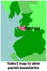
View a map of the boundaries of this town/parish.
You can see maps centred on OS grid reference SD489458 (Lat/Lon: 53.905641, -2.779289), Garstang which are provided by:
- OpenStreetMap
- Google Maps
- StreetMap (Current Ordnance Survey maps)
- Bing (was Multimap)
- Old Maps Online
- National Library of Scotland (Old Ordnance Survey maps)
- Vision of Britain (Click "Historical units & statistics" for administrative areas.)
- English Jurisdictions in 1851 (Unfortunately the LDS have removed the facility to enable us to specify a starting location, you will need to search yourself on their map.)
- Magic (Geographic information) (Click + on map if it doesn't show)
- GeoHack (Links to on-line maps and location specific services.)
- All places within the same township/parish shown on an Openstreetmap map.
- Nearby townships/parishes shown on an Openstreetmap map.
- Nearby places shown on an Openstreetmap map.
The Workhouse site has an interesting description of Garstang workhouse.
For probate purposes prior to 1858, Garstang was in the Archdeaconry of Richmond, in the Diocese of Chester. The original Lancashire wills for the Archdeaconry of Richmond are held at the Lancashire Record Office.
- Lancashire Family History & Heraldry Society - Fylde Branch
- Lancashire Family History & Heraldry Society - Preston Branch
- Lancashire Parish Register Society
You can also see Family History Societies covering the nearby area, plotted on a map. This facility is being developed, and is awaiting societies to enter information about the places they cover.

