Hide
Appleton Le Street
hide
Hide
hide
Hide
Hide
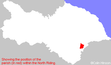
The Ancient Parish of APPLETON LE STREET
[Transcribed information mainly from the early 1820s]
"APPLETON LE STREET, a parish in the wapentake of Rydale; 4 miles WNW. of Malton. The church dedicated to All Saints (see Churches for photograph), in the deanry of Rydale, is an ancient structure, the living is a vicarage, of which the Rev. James Jarvis Cleaver, is the incumbent, and the Rev. William Sutcliffe, the curate, in the patronage of Trinity College, Cambridge. Pop. 173.""AMOTHERBY, in the parish of Appleton le Street, and wapentake of Rydale; 1 mile E. of Appleton le Street, 2½ miles NW. of Malton. Here is a grammar school, endowed with twenty acres of land, present rent £22. per annum. Here is a Chapel of Ease (see Churches for photograph) to the parish church, of which the Rev. William Sutcliffe is curate. Pop. 249."
"BROUGHTON, in the parish of Appleton le Street, and wapentake of Rydale; 2 miles E. of Appleton le Street, 1½ miles NW. of Malton. Population, 94."
"EAST THORPE, 3 houses in the township and parish of Appleton le Street, wapentake of Rydale; (East Thorpe House, the residence of the E. Taylor Esq.), 1¼ miles S. of Appleton le Street, 3 miles from Malton."
"HILDENLEY, (the seat of George Strickland, Esq.) in the parish of Appleton le Street and wapentake of Rydale; 2 miles SSE. of Appleton le Street, 8 miles WSW. of Malton, a small hamlet, the residence of George Strickland, Esq. Pop. 23."
"NEWSHAM, of a few a farm houses in the township of Butterwick-cum-Newsam, and parish of Appleton-le-Street, wapentake of Rydale; 1¾ miles NNE. of Appleton le Street, 4 miles from Malton. Population included in Butterwick."
"SWINTON, in the parish of Appleton le Street, and wapentake of Rydale; 1½ miles E. of Appleton le Street, 2 miles WNW. of Malton. Here is a Chapel of Ease to Appleton le Street, and a Methodist chapel, Old Connexion. Population, 334."
[Description(s) edited mainly from various 19th century sources by Colin Hinson. ©2010]
Hide
- Here are photographs of Churches etc. in the parish:
- All Saints' Church, Appleton le Street. (The Church's website is here.)
- Internal view looking down the aisle
- The East Window
- The font
- St. Helen's Church, Amotherby. (The Church's website is here.)
- Internal view looking down the nave
- The East Window
- The font
- Ex Methodist Chapel (now a private dwelling), Swinton.
- The ex-Wesleyan Methodist Chapel, Swinton (built in 1816), now used as a band room.
- All Saints' Church, Appleton le Street. (The Church's website is here.)
- Transcript of the entry for Appleton le Street in the "Collections relative to Churches and Chapels".
- Transcript of the entry for Amotherby in the "Collections relative to Churches and Chapels".
- Transcript of the entry for Swinton in the "Collections relative to Churches and Chapels".
- The whereabouts and dates of the Registers etc. for the Parish of Appleton le Street.
- The List of Incumbents in St. Helen's Church, Amotherby.
- The List of Chaplains and Curates in St. Helen's Church, Amotherby.
- The List of Team Vicars and Rectors in St. Helen's Church, Amotherby.
- The List of Incumbents in All Saints Church, Appleton le Street.
- Transcript of the entry of "professions and trades" in the Baines's Directory of 1823, of the North Riding.
- Transcript of the entry of "professions and trades" in the White's Directory of 1840, Yorkshire section.
- Transcript of the entry of "professions and trades" in the Bulmers Directory of 1890. of the North Riding.
- There is further information about this parish from the National Gazetteer 1868, Yorkshire extracts.
- There is further information about this parish from the Lewis's Topographical Dictionary of England 1835, Yorkshire extracts.
- There is further information about this parish from the Bulmer's 1890 History and Directory of the North Riding.
- Ask for a calculation of the distance from Appleton Le Street to another place.

- For a detailed map of this parish see this parish boundaries map.
- For a more detailed map of the parishes in the riding please see the Yorkshire parish maps page.
- For a more detailed map of the county please see the Yorkshire map page.
- Here is a map showing the wapentakes for the county.
You can see maps centred on OS grid reference SE736736 (Lat/Lon: 54.152955, -0.874557), Appleton Le Street which are provided by:
- OpenStreetMap
- Google Maps
- StreetMap (Current Ordnance Survey maps)
- Bing (was Multimap)
- Old Maps Online
- National Library of Scotland (Old Ordnance Survey maps)
- Vision of Britain (Click "Historical units & statistics" for administrative areas.)
- English Jurisdictions in 1851 (Unfortunately the LDS have removed the facility to enable us to specify a starting location, you will need to search yourself on their map.)
- Magic (Geographic information) (Click + on map if it doesn't show)
- GeoHack (Links to on-line maps and location specific services.)
- All places within the same township/parish shown on an Openstreetmap map.
- Nearby townships/parishes shown on an Openstreetmap map.
- Nearby places shown on an Openstreetmap map.
- The 1939-1945 Memorial Plaque of St. Helen's Church, Amotherby.
- The Roll of Honour in St. Helen's Church, Amotherby.
- The World War I War Memorial in St. Helen's churchyard, Amotherby
- This parish is covered (or partly covered) by the following Societies:

