
Hide
Thornton Dale
hide
Hide
hide
Hide
Hide
The Ancient Parish of THORNTON DALE
[Transcribed information mainly from the early 1820s]
"THORNTON DALE, a parish in the wapentake and liberty of Pickering Lythe; 2½ miles E. of Pickering. There is here a Free School, built and endowed by Lady Lumley. with a salary of £40. per annum to the master, £10. to the usher, and £20. for every first sermon preached by any of the persons brought up at this school. There are also 12 charity homes. built and endowed by the same lady, for 12 poor persons, with £11. 10s. per annum each, appertaining to the following places, six to Sinnington, four to Thornton, one to Ellerburn, and one to Marton. The church here is dedicated to All Saints (see Churches for photograph); the living is a rectory, in the patronage of R. Hill, Esq. There are also chapels for the Methodists and the Primitive Methodists. Pop, 879.""EAST MARISHES, a few farm houses in the township and parish of Thornton Dale, wapentake of Pickering-Lythe; 4 miles from Pickering."
"FARMANBY, a township in the parishes of Ellerburn and Thornton Dale, wapentake and liberty of Pickering Lythe; 2 miles ESE. of Pickering. Pop. 403."
"HIGH DALBY, (and Low Dalby) 3 farm houses in the township and parish of Thornton Dale, wapentake and liberty of Pickering Lythe; 3¾ miles NNE. of Thornton Dale, 5 miles NE. of Pickering."
"NEWSTEAD GRANGE, a farm house in the township and parish of Thornton Dale; 2 miles S. of Thornton Dale, 5 miles from Pickering and Malton."
[Description(s) edited mainly from various 19th century sources by Colin Hinson. ©2010]
Hide
- Here are photographs of Churches in the parish:
- All Saints' Church, Thornton Dale. (The Church's website is here.)
- Internal view looking down the nave
- and a slightly different view of the same Church.
- Thornton Dale Methodist Church, Thornton Dale. (The Church's website is here.)
- All Saints' Church, Thornton Dale. (The Church's website is here.)
- Transcript of the entry for Thornton Dale in the "Collections relative to Churches and Chapels".
- The whereabouts and dates of the Registers etc. for the Parish of Thornton Dale.
- Transcript of the entry of "professions and trades" in the Baines's Directory of 1823, of the North Riding.
- Transcript of the entry of "professions and trades" in the White's Directory of 1840, Yorkshire section.
- Transcript of the entry of "professions and trades" in the Bulmers Directory of 1890. of the North Riding.
- There is further information about this parish from the Pigot's 1829 Directory, Yorkshire section.
- There is further information about this parish from the Pigot's 1834 Directory, Yorkshire section.
- There is further information about this parish from the National Gazetteer 1868, Yorkshire extracts.
- There is further information about this parish from the Lewis's Topographical Dictionary of England 1835, Yorkshire extracts.
- There is further information about this parish from the Bulmer's 1890 History and Directory of the North Riding.
- Ask for a calculation of the distance from Thornton Dale to another place.
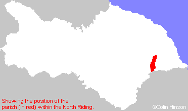
- For a detailed map of this parish see this parish boundaries map.
- For a more detailed map of the parishes in the riding please see the Yorkshire parish maps page.
- For a more detailed map of the county please see the Yorkshire map page.
- Here is a map showing the wapentakes for the county.
You can see maps centred on OS grid reference SE834830 (Lat/Lon: 54.23592, -0.721938), Thornton Dale which are provided by:
- OpenStreetMap
- Google Maps
- StreetMap (Current Ordnance Survey maps)
- Bing (was Multimap)
- Old Maps Online
- National Library of Scotland (Old Ordnance Survey maps)
- Vision of Britain (Click "Historical units & statistics" for administrative areas.)
- English Jurisdictions in 1851 (Unfortunately the LDS have removed the facility to enable us to specify a starting location, you will need to search yourself on their map.)
- Magic (Geographic information) (Click + on map if it doesn't show)
- GeoHack (Links to on-line maps and location specific services.)
- All places within the same township/parish shown on an Openstreetmap map.
- Nearby townships/parishes shown on an Openstreetmap map.
- Nearby places shown on an Openstreetmap map.
- The World War II Memorial Plaque in All Saints Church, Thornton Dale.
- The World War I Roll of Honour in All Saints Church, Thornton Dale.
- This parish is covered (or partly covered) by the following Societies: