
Hide
Yarm
hide
Hide
hide
Hide
Hide
hide
Hide
The Ancient Parish of YARM
[Transcribed information mainly from the early 1820s]
"YARM, a parish in the wapentake and liberty of Langbargh; 4 miles from Stockton, 15 from Guisborough, 16 from Northallerton, and 44 from York, The town is situated on a low peninsula, and is nearly surrounded by the river Tees, which winds round in the form of a horse shoe, and is here navigable for vessels of sixty tons burthen." (There is further information for Yarm). [Description(s) edited mainly from various 19th century sources by Colin Hinson. ©2010]
Hide
- Here are photographs of Churches etc. in the parish:
- St. Mary Magdalene's Church, Yarm (view 1).
- St. Mary Magdalene's Church, Yarm (view 2).
- St. Mary and St. Romuald's Roman Catholic Church, Yarm.
- This Church was originally built by the Meynell family for their own use when they were Lords of the manor, living at The Friarage.
- The Methodist Church, Yarm. (The Church's website is here.)
- Transcript of the entry for Yarm in the "Collections relative to Churches and Chapels".
- The whereabouts and dates of the Registers etc. for the Parish of Yarm.
- Transcript of the entry of "professions and trades" in the Baines's Directory of 1823, of the North Riding.
- Transcript of the entry of "professions and trades" in the Pigot's 1829 Directory, Yorkshire section.
- Transcript of the entry of "professions and trades" in the Pigot's 1834 Directory, Yorkshire section.
- Transcript of the entry of "professions and trades" in the White's Directory of 1840, Yorkshire section.
- Transcript of the entry of "professions and trades" in the Bulmers Directory of 1890. of the North Riding.
- There is further information about this parish from the Pigot's 1829 Directory, Yorkshire section.
- There is further information about this parish from the Pigot's 1834 Directory, Yorkshire section.
- There is further information about this parish from the National Gazetteer 1868, Yorkshire extracts.
- There is further information about this parish from the Lewis's Topographical Dictionary of England 1835, Yorkshire extracts.
- There is further information about this parish from the Stephen Whatley's Gazetteer 1750, Yorkshire extracts.
- There is further information about this parish from the Bulmer's 1890 History and Directory of the North Riding.
- Ask for a calculation of the distance from Yarm to another place.
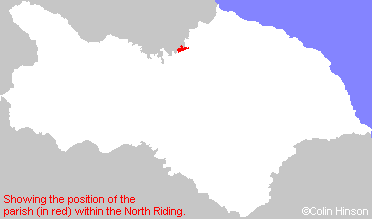
- For a detailed map of this parish see this parish boundaries map.
- For a more detailed map of the parishes in the riding please see the Yorkshire parish maps page.
- For a more detailed map of the county please see the Yorkshire map page.
- Here is a map showing the wapentakes for the county.
You can see maps centred on OS grid reference NZ420120 (Lat/Lon: 54.501589, -1.352968), Yarm which are provided by:
- OpenStreetMap
- Google Maps
- StreetMap (Current Ordnance Survey maps)
- Bing (was Multimap)
- Old Maps Online
- National Library of Scotland (Old Ordnance Survey maps)
- Vision of Britain (Click "Historical units & statistics" for administrative areas.)
- English Jurisdictions in 1851 (Unfortunately the LDS have removed the facility to enable us to specify a starting location, you will need to search yourself on their map.)
- Magic (Geographic information) (Click + on map if it doesn't show)
- GeoHack (Links to on-line maps and location specific services.)
- All places within the same township/parish shown on an Openstreetmap map.
- Nearby townships/parishes shown on an Openstreetmap map.
- Nearby places shown on an Openstreetmap map.
- This parish is covered by the following Society: