Hide
Kirkham
hide
Hide
hide
Hide
hide
Hide
Hide
KIRKHAM, a small town, a township, and a sub-district, in Fylde district, and a parish partly also in Preston and Garstang districts, Lancashire. The town stands near the Preston and Wyre railway, 3 miles N of Naze Point on the Ribble estuary, and 8 WNW of Preston; has been regarded as the capital of the Fylde country; comprises several well built streets; has a good supply of water, and fair sanitary arrangements under a local board of health; is a seat of petty sessions and county courts; and has a post office under Preston, a railway station, a magistrates' office, a church, Independent and Wesleyan chapels, a Roman Catholic chapel, a reading room and library, a free grammar school, a girls' charity school, a national school, a workhouse, and some charities. The church succeeded a Norman one, which was given by Roger de Poitiers to Shrewsbury Abbey, and by Edward I. to Vale-Royal abbey; comprises a nave of 1822, a tower and spire of 1844, and a chancel of 1853, together with a N transept; and is convenient and spacious. The Roman Catholic chapel is at the Willows, ½ a mile from the town; was built in 1845, after designs by Pugin; is in the early English style; and consists of nave, aisles, chancel, and porch, with tower and octagonal spire. The grammar school was founded in 1658; affords both an English and a classical education; and has £596 a year from endowment, and two exhibitions of £60 a year to Cambridge. The workhouse is that of the Fylde district; has attached to it large garden ground; and, at the census of 1861, had 110 inmates. Fairs are held on 4 and 5 Feb., 28 and 29 April, and 18 and 19 Oct.; and there are flax mills in the town, and cotton mills in the adjoining township of Medlar-with-Wesham. The town and the township are regarded as conterminate. Acres, 840. Real property, £7,450; of which £162 are in gas works. Pop. in 1851, 2,799; in 1861, 3,380. Houses, 616. The sub-district contains also the townships of Freckleton, Warton, Bryning-with-Kellamergh, Ribby-with-Wrea, Westby-with-Plumpton, Weeton-with-Preese, Greenalgh-with-Thistleton, Cliftonwith-Salwick, Newton-with-Scales, Medlar-with-Wesham, Little Eccleston-with-Larbreck, Treals, Roseacre, and Wharles, and Elswick. Acres, 31,464. Pop. in 1851, 8,464; in 1861, 9,141. Houses, 1,740. The parish contains all the sub-district, except Elswick township; and contains also the townships of Whittingham, Goosnargh-with-Newsham, Great and Little Singleton, and the chapelry of Hambleton. Acres, 48,530. Real property, £73,737. Pop. in 1851, 10,926; in 1861, 11,445. Houses, 2,191. The living is a vicarage in the diocese o Manchester. Value, £1,080.* Patron, Christ Church, Oxford The p. curacies of Goosnargh, Great Singleton, Hambleton, Lund, Ribby-with-Wrea, Treales, Weeton, Whitechapel, and Warton-with-Freckleton, are separate benefices.
John Marius Wilson, Imperial Gazetteer of England and Wales (1870-72)
Hide
Kirkham Library,
Station Road,
Kirkham
Preston
PR4 2HD
Additional Local Studies information is held at St. Annes Library.
The following books contain useful information about the history of Kirkham and the surrounding area.
- The History of the Fylde of Lancashire. John Porter 1876, reprinted by S.R. Publishers Ltd. 1968 SBN 85409 532 2.
- Fylde Folk. Kathleen Eyre 1970. SBN 9501373 0 8. J.Brewer & Son.
- Windmill Land. Allen Clarke 1933. W. Foulsham & Co. Ltd.
| Poulton St Congregational, Kirkham |
| Zion Independent, Kirkham |
| St John The Evangelist, Roman Catholic, Kirkham |
Details about the census records, and indexes for Kirkham.
| Poulton St Congregational, Kirkham |
| Zion Independent, Kirkham |
| St John The Evangelist, Roman Catholic, Kirkham |
St John the Evangelist, The Willows (Roman Catholic)
The LFH&HS have published marriages 1837-1995, baptisms 1855-1970 and burials 1839-1993.
The Register Office covering the Kirkham area is Blackpool & Fylde.
The National Gazetteer of Great Britain and Ireland - 1868
- Ask for a calculation of the distance from Kirkham to another place.
In 1835 the parish of Kirkham contained the townships of Kirkham Hambleton, Singleton, Larbreck with Little Eccleston, Greenhalgh, Weeton with Preese, Medlar with Wesham, Treales, Roseacre and Wharles, Westby with Plumpton, Ribby with Wrea, Bryning with Kellamergh, Warton, Freckleton, Newton with Scales, Clifton with Salwick, Goosnargh and Whittingham.
Information about boundaries and administrative areas is available from A Vision of Britain through time.
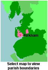
View a map of the boundaries of this town/parish.
You can see maps centred on OS grid reference SD419319 (Lat/Lon: 53.780514, -2.883906), Kirkham which are provided by:
- OpenStreetMap
- Google Maps
- StreetMap (Current Ordnance Survey maps)
- Bing (was Multimap)
- Old Maps Online
- National Library of Scotland (Old Ordnance Survey maps)
- Vision of Britain (Click "Historical units & statistics" for administrative areas.)
- English Jurisdictions in 1851 (Unfortunately the LDS have removed the facility to enable us to specify a starting location, you will need to search yourself on their map.)
- Magic (Geographic information) (Click + on map if it doesn't show)
- GeoHack (Links to on-line maps and location specific services.)
- All places within the same township/parish shown on an Openstreetmap map.
- Nearby townships/parishes shown on an Openstreetmap map.
- Nearby places shown on an Openstreetmap map.
For probate purposes prior to 1858, Kirkham was in the Archdeaconry of Richmond, in the Diocese of Chester. The original wills for the Archdeaconry of Richmond are held at the Lancashire Record Office.
You can also see Family History Societies covering the nearby area, plotted on a map. This facility is being developed, and is awaiting societies to enter information about the places they cover.

