
Hide
Whitby
hide
Hide
hide
Hide
Hide
The Ancient Parish of WHITBY
[Transcribed information mainly from the early 1820s]
"WHITBY, a parish in the wapentake and liberty of Whitby Strand; 22 miles from Guisborough, 20 from Scarborough, 31 from Stokesley, and 47 from York; in 54 deg. 29 min. 24 sec. north latitude, and 35 mm. 59 sec. west longitude. The town stands on two opposite declivities, at the mouth of the Eske, by which river it is divided into two parts, which are connected by a draw-bridge so constructed as to admit vessels of 32 feet wide." (There is further information for Whitby).Information on the following places in this Parish is contained on a supplementary page.
|
|
|
[Description(s) edited mainly from various 19th century sources by Colin Hinson. ©2010]
Hide
- The Whitby Museum website gives details of the documents the museum holds.
- Here are photographs of Churches etc. in the parish:
- St. Mary the Virgin's Church, Whitby.
- St. Mary the Virgin's Church, Whitby in spring.
- St. Mary the Virgin's Church, Whitby at night.
- St. Hilda's Church, Whitby.
- Internal view looking down the nave
- Internal view looking across the nave
- The East Window
- The font
- The Church of St. John the Evangelist, Whitby.
- Internal view looking down the nave
- The font
- Sneaton Castle and St. Hilda's Priory, Whitby. The Priory is The Mother House of the Holy Paraclete (an Anglican Religious Community) and the 19th century Castle is a conference centre.
- St. Hilda's Priory, Sneaton Castle.
- St. Hilda's Roman Catholic Church, Whitby.
- The former St. Ninian's Anglican-Catholic Church, Whitby, built in 1777-8, closed in 2013.
- Internal view looking down the nave
- The font
- The United Reformed Church, Whitby.
- The former Methodist Church, Whitby.
- Internal view looking down the nave
- Internal view looking across the nave
- The former Methodist Chapel Cleveland Terrace, Whitby.
- The Ruins of the Abbey, Whitby.
- St. Margaret's Church, Aislaby.
- All Saints' Church, Hawsker, built in 1870, view 1. (The Church's website is here.)
- All Saints' Church, Hawsker, view 2.
- The Methodist Church, Hawsker - ex Wesleyan, opened in 1851. (The Church's website is here.)
- St. Bartholomew's Church, Ruswarp, view 1.
- St. Bartholomew's Church, Ruswarp, view 2.
- The Church of St. John the Evangelist, Sleights.
- Internal view looking down the nave
- The font
- The Methodist Church, Briggswath - ex Wesleyan, opened 1905. (The Church's website is here.)
- All Saints' Church, Ugglebarnby.
- The Methodist Chapel, Littlebeck.
- The Wesleyan Chapel, Newholme, opened in 1852.
- The former Church of England Chapel, Dunsley. Served as an outreach of St Margaret's C of E Church at Aislaby near Whitby and was formerly Dunsley School. Is now a private dwelling.
- A transcript of Iburndale Congregational Church History
- A transcript of Whitby-Flowergate Congregational Church History
- A transcript of Whitby-Cliff Lane Congregational Church History
- A transcript of Whitby-Silver Street Congregational Church History
- Transcript of the entry for Whitby in the "Collections relative to Churches and Chapels".
- Transcript of the entry for Aislaby in the "Collections relative to Churches and Chapels".
- Transcript of the entry for Sleights in the "Collections relative to Churches and Chapels".
- Transcript of the entry for Ugglebarnby in the "Collections relative to Churches and Chapels".
- The whereabouts and dates of the Registers etc. for the Chapelry of Eskdaleside.
- The whereabouts and dates of the Registers etc. for the Chapelry of Ugglebarnby.
- The whereabouts and dates of the Registers etc. for the Parish of Whitby.
- Here is a mulitple photo. panoramic view of Whitby Harbour.
- Here is a photo of Whitby including the harbour and St. Mary's Church.
- Here is a photograph of The Houses on Boulby Bank, in the 1920s..
- Whitby on line.
- Transcript of the entry of "professions and trades" in the Baines's Directory of 1823, of the North Riding.
- Transcript of the entry of "professions and trades" in the Pigot's 1829 Directory, Yorkshire section.
- Transcript of the entry of "professions and trades" in the Pigot's 1834 Directory, Yorkshire section.
- Transcript of the entry of "professions and trades" in the White's Directory of 1840, Yorkshire section.
- Transcript of the entry of "professions and trades" in the Bulmers Directory of 1890. of the North Riding.
- Transcript of the entry of "professions and trades" in the The Scarborough Gazette of 1905,
- There is further information about this parish from the Pigot's 1829 Directory, Yorkshire section.
- There is further information about this parish from the Pigot's 1834 Directory, Yorkshire section.
- There is further information about this parish from the National Gazetteer 1868, Yorkshire extracts.
- There is further information about this parish from the Lewis's Topographical Dictionary of England 1835, Yorkshire extracts.
- There is further information about this parish from the Stephen Whatley's Gazetteer 1750, Yorkshire extracts.
- There is further information about this parish from the Bulmer's 1890 History and Directory of the North Riding.
- Ask for a calculation of the distance from Whitby to another place.
- A few years before 1890, the townships of Eskdaleside and Ugglebarnby (in this parish) were amalgamated and became a separate parish. See Eskdaleside with Ugglebarnby Parish.
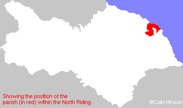
- For a detailed map of this parish see this parish boundaries map.
- For a more detailed map of the parishes in the riding please see the Yorkshire parish maps page.
- For a more detailed map of the county please see the Yorkshire map page.
- Here is a map showing the wapentakes for the county.
You can see maps centred on OS grid reference NZ901113 (Lat/Lon: 54.489047, -0.610621), Whitby which are provided by:
- OpenStreetMap
- Google Maps
- StreetMap (Current Ordnance Survey maps)
- Bing (was Multimap)
- Old Maps Online
- National Library of Scotland (Old Ordnance Survey maps)
- Vision of Britain (Click "Historical units & statistics" for administrative areas.)
- English Jurisdictions in 1851 (Unfortunately the LDS have removed the facility to enable us to specify a starting location, you will need to search yourself on their map.)
- Magic (Geographic information) (Click + on map if it doesn't show)
- GeoHack (Links to on-line maps and location specific services.)
- All places within the same township/parish shown on an Openstreetmap map.
- Nearby townships/parishes shown on an Openstreetmap map.
- Nearby places shown on an Openstreetmap map.
- The World War I Roll of Honour in St. John's Church, Whitby.
- The World War I Memorial Plaque in St. John's Church, Sleights.
- The World War II Memorial Plaque in St. John's Church, Sleights.
- The War Memorial at Sleights.
- The War Memorial at Aislaby
- This parish is covered (or partly covered) by the following Societies: